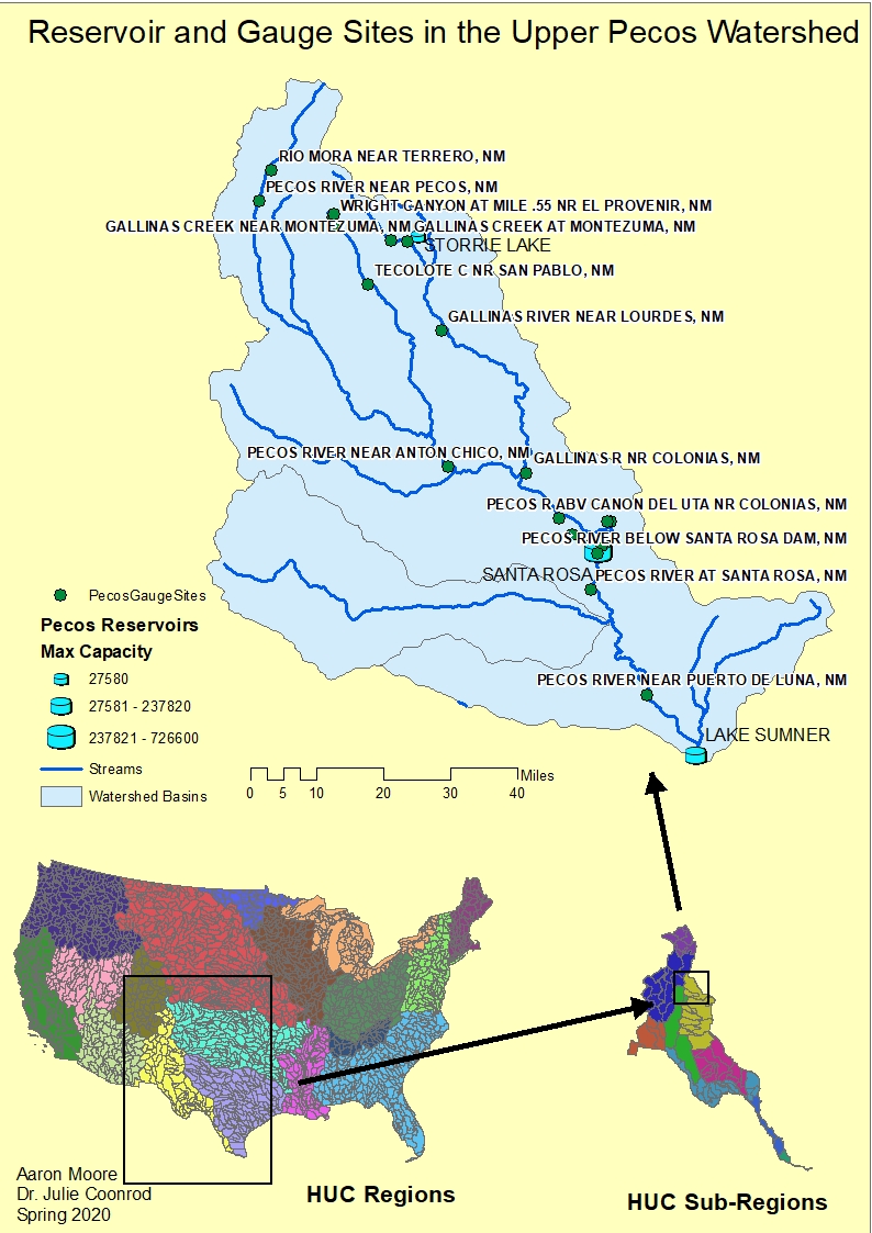
This map delineates the Upper Pecos
Watershed from U.S. Hydrologic Unit Codes (HUCs).
The streams and reservoirs are
highlighted, as well as the locations of all gauge measurement sites in the
area.
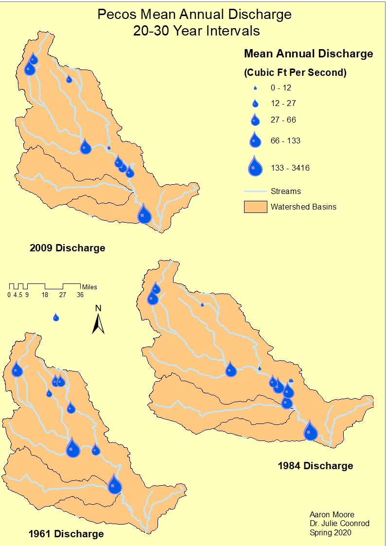
This map shows annual mean discharge
for the year my mother was born, the year I was born and a more recent year,
2009.