HOMEWORK 1
In these exercises, I
learned to navigate the software. I have used these skills in the past, but
many of the things I thought I remembered, I had forgotten. Chapter 3 also went
through a great deal of vocabulary that is integral in understanding the basic
skills needed for ArcGIS. Many of this vocabulary deals with the “Tools” used
to manipulate the map, and its features in order to optimize what you want to
display. Below are some of my notes I took while discovering and playing with
the new tools.
Tools:
Identify: blue
circle with letter “i” on it. Identify show the
"attributes" of whatever you clicked on, stored in a dataset.
Attribute table:
you can hide data without deleting it, basically do the same as you would in
excel
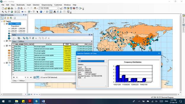
Statistics:
Right click an attribute or many to see what stats are in the data
Feature class: a
collection of data of the same type (ie polygon),
same attributes and same spatial reference. They can be stored in geodatabases,
shapefiles, coverages, etc. Data can have the same feature class but different symbology
(way of being displayed).
Create Viewer
Window: Looks like a smaller window, allow you to open a separate window to
view a zoomed in section of the map, two views of the same map simultaneously
Magnifier:
within the viewer window, you can make it act like a magnifying glass (right
arrow, magnifier)
Find: small
binoculars, allows you to search for feature within your map and zoom directly
to them
Bookmark: store
whatever feature you found first in order to look for another feature without
losing your place
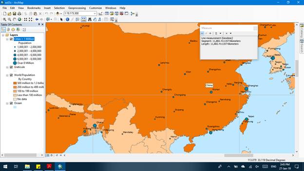
Measure: looks
like a ruler, allows you to measure the shortest distance between two features
I feel that I gained
a better understanding of ArcGIS and how to use it in a very basic sense. In
the future, I would like to learn how to grab pictures of my maps without just
screenshotting them or using print screen to copy and paste. I would like to learn
to publish a map, create a legend, scale bars, etc. so that I can use a map for
more than just reference on a computer. I would also like to learn more about
how to mesh different polygon data so that I can compare data that covers
landscapes (ie which areas have been affected by
flood and fire).