Homework 5:
The following maps show the Rio
Pecos Headwaters, various stream gauges and gauge data for 3 years.
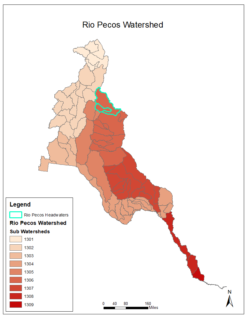
This map shows the entire Rio Pecos watershed with the various
sub-basins in different colors. The Rio Pecos headwaters are
highlighted in turquoise.
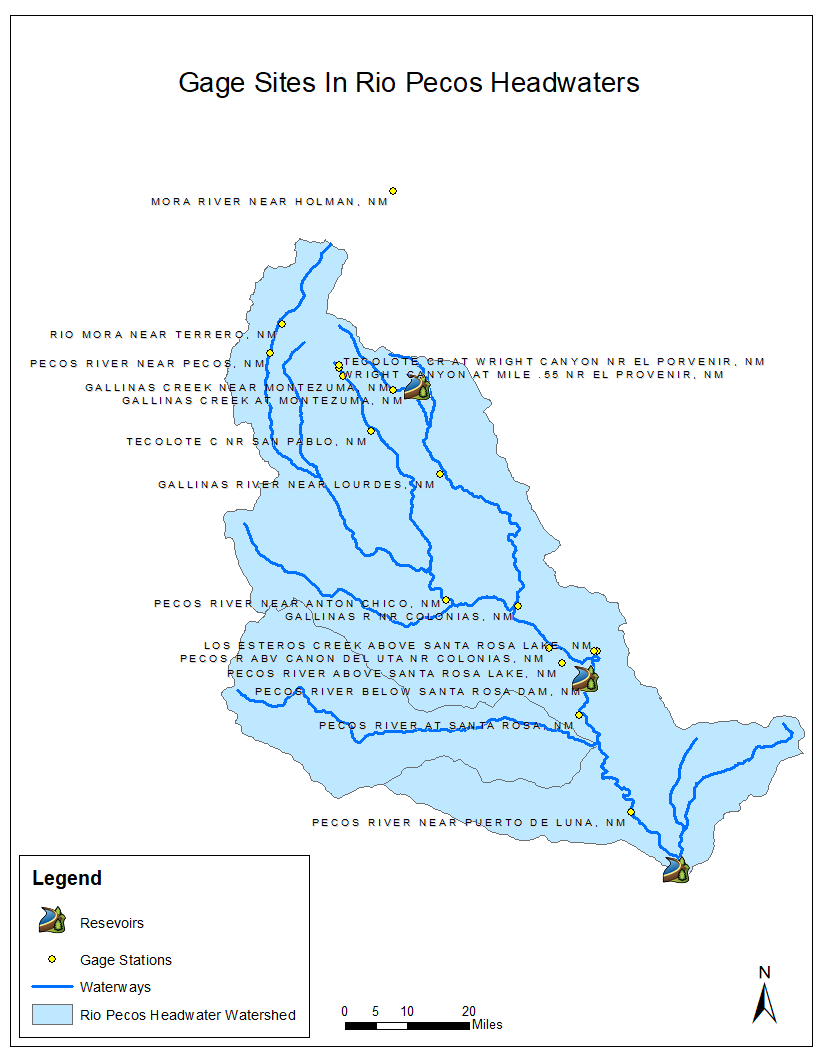
The map above shows the entire Rio Pecos headwaters; the stream gauges are marked by yellow dots and the reservoirs are
marked by larger icons. Waterways are highlighted by
blue lines.

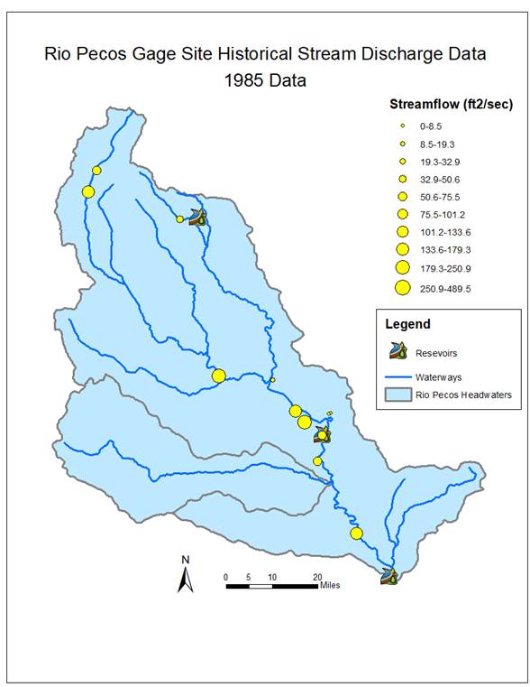

The three maps above illustrate the measurements from the
stream gauges during three years. Larger yellow dots mark a higher stream flow
at that gauge site.