Identifying Potential Habitat for
Northern Long Eared Bats
Methods
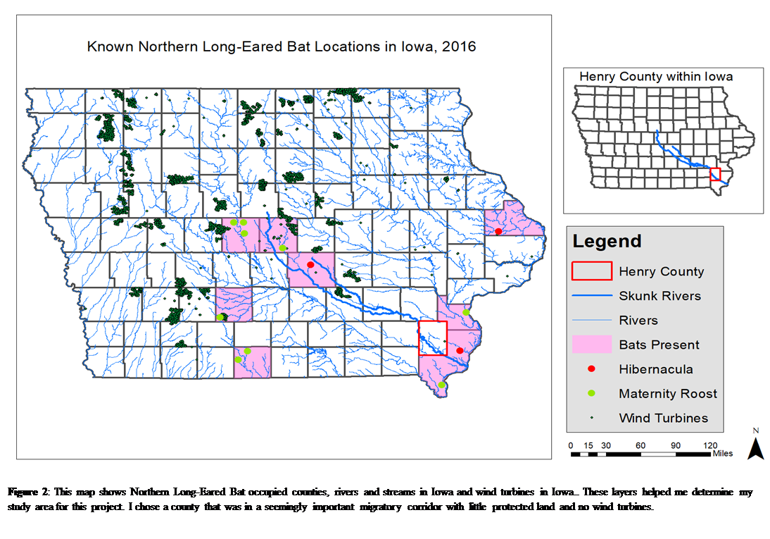
After importing my base layers including the rivers
and streams, Iowa Counties, and Iowa Townships, I utilized information from the
U.S. Fish and Wildlife Service to create a point shapefile
indicating where Northern Lon-Eared Bat hibernacula and roost trees are. I
added the wind turbine shapefile and decided that I
wanted to focus my analysis on the part of the state that was the most
inhabited by bats and the least developed with wind energy.
The Skunk River and its tributaries seem like a
natural corridor between hibernacula and maternity roosts. I utilized the
Protect Area Database and found that Henry County does not contain any
protected lands; I decided to identify and quantify potential habitat in this
county. Using the “Select by Attribute”
tool, I selected the Skunk Rivers. I buffered the river to 0.25 miles on either
side of the river (0.5 miles across) and clipped the NLCD raster to the
buffered Skunk River shape.
I clipped the Skunk River NLCD Raster to Henry
County. I used the field calculator to determine how many acres of each land
use are found in the clipped raster by multiplying the
area of the raster cell by the number of raster cells for each land use.