Figure 4
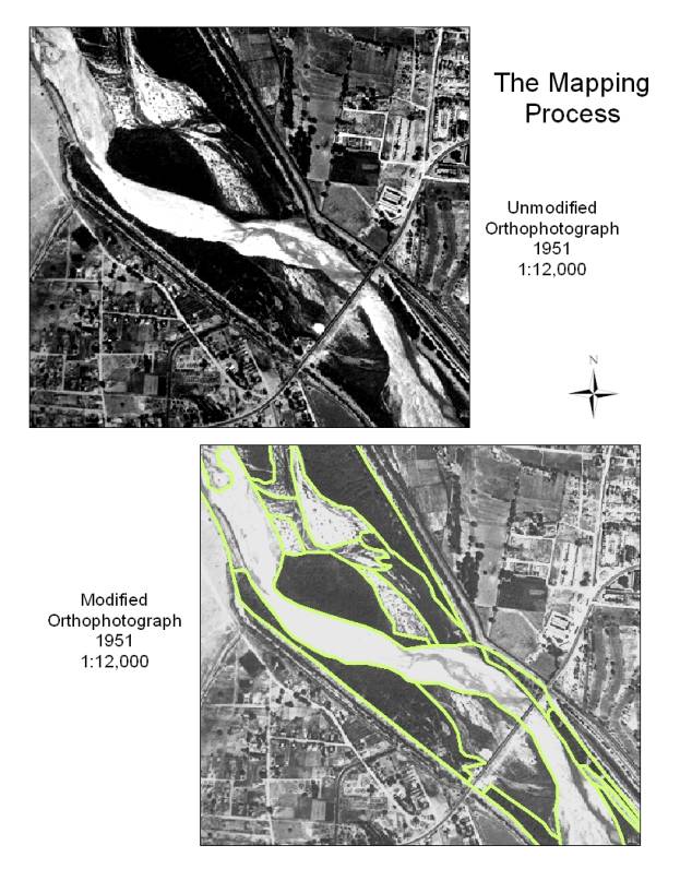
Figure 4. An example of the orthophotographs used to create the historic vegetation maps. The images were often dark or blurry. Although nothing could be done about the resolution of the images, they could be adjusted within ArcMap to increase contrast in the display.