Comparison of Satellite-Based Soil Moisture
Estimates
and Rainfall Data for a New Mexico Watershed
Background Study Area
Data
Methods
Results &
Conclusions
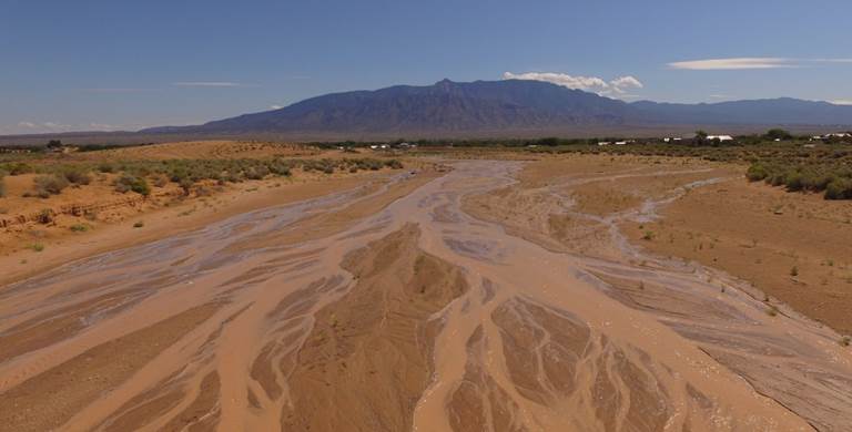 Antecedent soil moisture conditions play an
important role in the generation of runoff and present a source of considerable
uncertainty for hydrologic analyses in dryland catchments. Prior knowledge about moisture conditions could
improve runoff predictions and flood risk forecasts. Tracking soil moisture along with rainfall
and discharge could also aid with calibration of hydrologic models and reduce
the uncertainty of model results. Many important policy decisions such as
watershed management, infrastructure design and flood plain delineation rely on
hydrologic simulations. Improved models
therefore have a direct impact on both the allocation of public resources and
public safety. This study compares remotely sensed soil moisture measurements
to radar and gage-based precipitation data for a watershed in central New
Mexico for a one-month period in 2018. The objective was to assess whether soil
moisture and precipitation data are correlated, and if measured rainfall can be
used as a proxy for soil moisture conditions.
Antecedent soil moisture conditions play an
important role in the generation of runoff and present a source of considerable
uncertainty for hydrologic analyses in dryland catchments. Prior knowledge about moisture conditions could
improve runoff predictions and flood risk forecasts. Tracking soil moisture along with rainfall
and discharge could also aid with calibration of hydrologic models and reduce
the uncertainty of model results. Many important policy decisions such as
watershed management, infrastructure design and flood plain delineation rely on
hydrologic simulations. Improved models
therefore have a direct impact on both the allocation of public resources and
public safety. This study compares remotely sensed soil moisture measurements
to radar and gage-based precipitation data for a watershed in central New
Mexico for a one-month period in 2018. The objective was to assess whether soil
moisture and precipitation data are correlated, and if measured rainfall can be
used as a proxy for soil moisture conditions.