Protecting the Greater Chaco Region: Oil and Gas industry could affect the Water Resources of the San Juan Basin
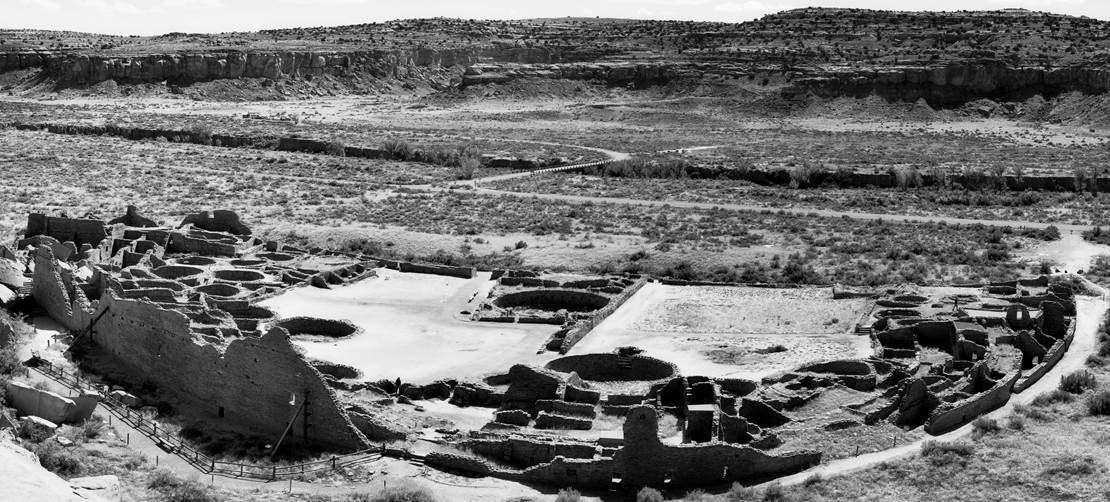
A large farm field

Description automatically generated

Image of the Chaco Canyon


A close up of a piece of paper

Description automatically generated


Background and Motivation:

For the past four years I have helped build a grassroots organization called Pueblo Action Alliance, which is a fiscally sponsored 501 c3 non-profit organization based in Tiwa territory known as present day Albuquerque. The organization formed in the wake of the Standing Rock movement and what we learned from the frontlines in North Dakota on the Lakota Standing Rock Indian Reservation we brought back to our ancestral homelands of the Pueblo, Dine and Apache peoples. We have organized against the oil and gas 
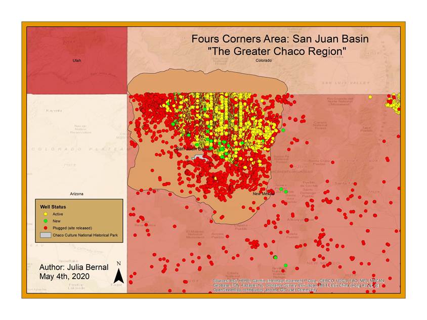
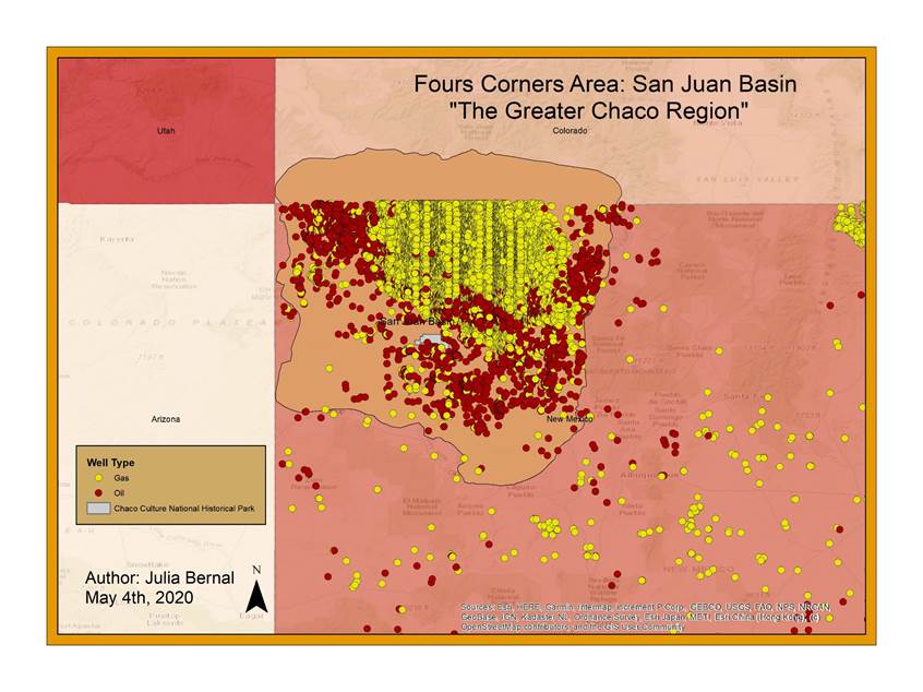
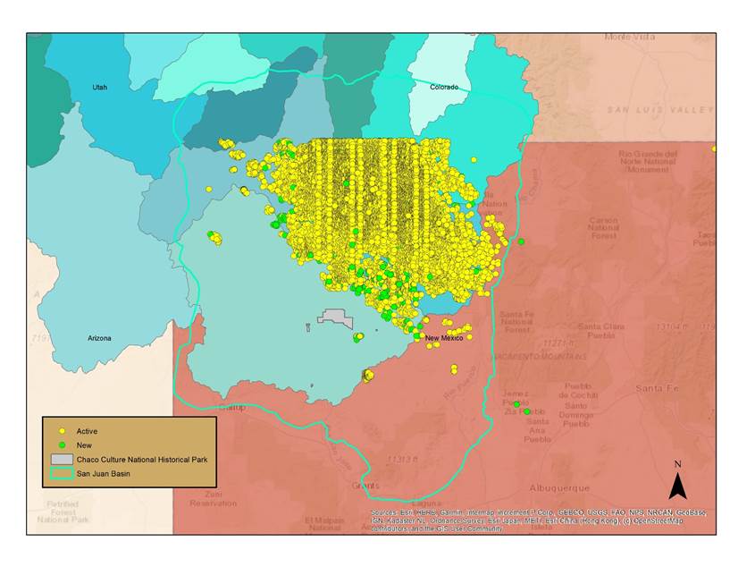
industry in the San Juan Basin, the Northwestern corner of New Mexico. The San Juan basin is one of the two oil and gas production areas of New Mexico according to the New Mexico Oil Conservancy District; the second is the Permian Basin which is the Southeastern corner of New Mexico crossing the border of Texas.


Objective and Location: 

Oil and gas industry in the San Juan basin which threatens the cultural integrity of the Chaco Canyon pueblo site, a site that is culturally respected and sacred to the Indigenous Pueblo people of New Mexico. Not only does its fracking operations encroach of the sacred and culturally sensitive sites, but it also impairs the air quality of the four corners area (Utah, Colorado, Arizona, and New Mexico).  


Methods:

Data Sources

1.      USGS HUC (Hydrologic Unit Codes) data for regions 13 (Rio Grande Basin) and 14 (Upper Colorado Basin)

a.      NHD (National Hydrography Datasets), HUC (Hydrologic Unit Maps), Raster Data

2.      National Park Service for Chaco Canyon Culture Historic Park  

3.      New Mexico Energy, Minerals, and Natural Resources Department

a.      State dataset with information every active and inactive well in the state as well as plugged wells

4.      Buerau of Land Management, Farmington Field Office for quaterly land leases for oil and gas industry

Projection:

The maps I created for the presentation I didn’t input the proper projection but f USA Contiguous Albers Equal Area Conic, central meridian set at -106.00. I used this projection because it accurately projects two standard parrells which won’t dissort the projection as much. I’m working with somewhat smaller regios, so I felt this project would be approperiate.


A picture containing food

Description automatically generatedA picture containing food

Description automatically generated

A picture containing text, map

Description automatically generated

Analysis: 


Results: 


Conclusion: 


A picture containing text, map

Description automatically generated

Future work: 

What I would like to eventually do, is attempt to do a basin study at looks at how both surface and groundwater have been impacted since the development of the oil and gas industry in the Greater Chaco Region.