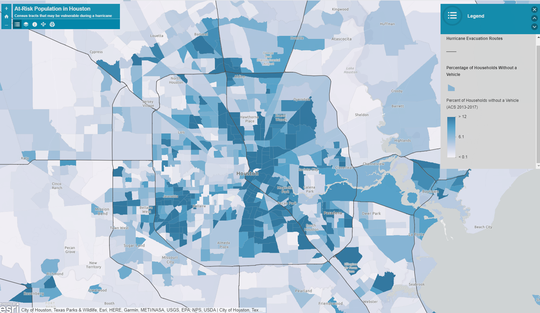
Figure 1. Using the GIS Online Exercise,
this map displays the Hurricane Evacuation Routes in Houston TX. It also
displays the percentage of Households without a vehicle further illustrating
the households who are at higher risk during a Hurricane Evacuation scenario.
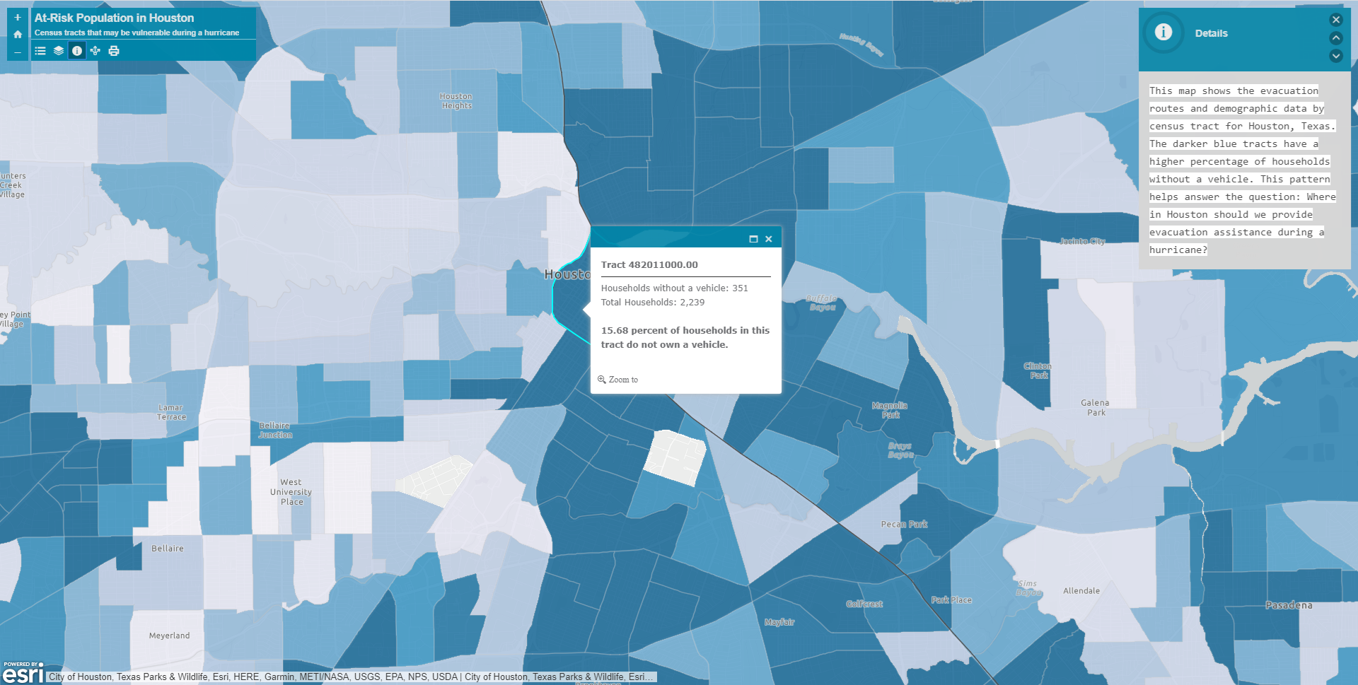
Figure 2. Example of a tract with a
high percentage of households without vehicles.
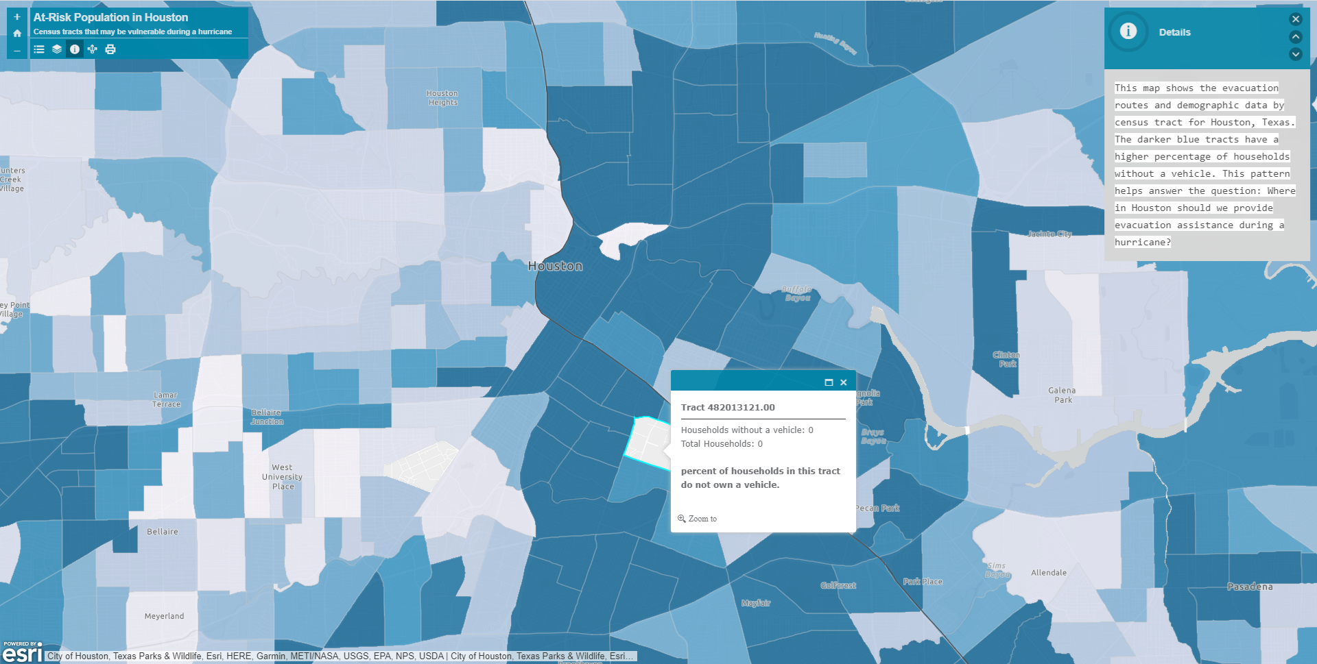
Figure 3. Example of a tract with households
that have vehicles.