
Introduction
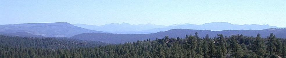
The area of study, Burns Canyon,
located on the Jicarilla Apache Reservation in northern New Mexico, was
chosen for a land suitability analysis.
The location can be retrieved from the quadrangle topographic map, Bixler
Ranch, Township 30N, Range 3W. (click here for map) This particular area is also situated on the outer most
western boundary of the San Juan Basin.
Geologically the San Juan Basin contains high levels of coal-bed
methane and this study area is currently being mined for the resource. In the mid-1950s oil and gas was
discovered on the reservation.
Currently there are approximately 130 gas wells within this township
range and nearly forty within the study area. Drilling the wells disrupts the lands, usually from clearing
the drill sites and from the roads created to access the sites. Oil & Gas companies usually have little
concern for the environmental, so mitigation measures are not
considered. I’m interested to see how
this land-use activity has impacted the landscape. Ultimately the goal is to conduct fieldwork to determine a land
suitability analysis. A land suitability
analysis helps determine the capabilities and limits to the landscape. The objective of this study is to utilize
GIS as a tool for assessing the impacts on the landscape from gas production.
Data collection from the field will need to be obtained to fully assess the
landscape, but the goal is to have GIS assist in formulating a hypothesis
prior to fieldwork. Methodology
To begin the process of GIS data collection I had to
search through RGIS to find the digital elevation for my study area. This was a tedious task because RGIS does
not label the DEMs by quad names, but by numbers. The New Mexico quad map had to be downloaded and a data query
was done to highlight quad map Bixler Ranch.
Through this process I was able to obtain the right 15' DEM quad,
which was #8. Ortho photo for Bixler
Ranch SE was also downloaded from RGIS.
Ortho photo for Bixler Ranch SE was also downloaded from RGIS. I also collected some soil data from the
National Resource Conservation Service (NRCS); fortunately they had the soil
data already in GIS coverages. The
data was projected in NAD_1927_UTM_Zone_13N.
I also obtained gas well data, with UTM coordinates, from NMTech. The coordinates were put in an excel table
to create a dbf file. Once the dbf
file was created, the table was added to ArcMap to display the X, Y
coordinates. From this created layer,
the data was exported to create a shape file of the gas wells. This shapefile eventually was projected to
match the DEM projection at GCS_Clark_1866_UTM_Zone_13N. The DEM’s original projection was the
Clark_1866 and I projected it to UTM_Zone_13N because the other data was in
UTM. I was told that this may have
been an unnecessary step, but all the data is projected with this projection
except for the soil with a NAD_1927.
For this particular project I do not think that the NAD_1927 and
Clark_1866 will make much difference when everything is projected in
UTM_Zone_13N. If I were working on a
project that required accuracy then identical projections would be
necessary.
|
Once all the data was projected, the
next task was to clip my DEM to my study area, which was the boundary of my
aerial photograph. This process was
fairly complicated because geoprocessing wizard only clips coverages and
geodatabases and the aerial was a Mr. Sid.
Without the help of the TA, Anne, I would not have been able to figure
this process out. ArcDoc was utilized
to do a grid clip on the DEM. The
grid clip asked for the coordinates x1, x2, y1,
and y2 to determine the area to be clipped. We used the aerial photo in ArcMap to
figure out the coordinates. This
information was plugged into ArcDoc and the DEM was clipped to the study
area. The clip also preserved the
projection. In order to clip my soils and well data to the study area, I also needed the study area to be converted to a coverage. ArcDoc was also utilized for this process. Before the clipped grid could be converted to a polygon ArcDoc required this function: elevint=int<clip>. I did not understand this function, but it was needed before the grid could be converted to a polygon. Grid poly was used in ArcDoc to convert the grid to coverage. Now all the data was ready for manipulation. The clipped DEM was used to compose
the hydrologic features. Spatial
analysis was activated to access the raster calculator. Through the raster calculator I was able
to create a flow direction, flow accumulation, streams, outlets, and
watersheds from the DEM. I was only
interested in the flow direction, flow accumulation, and streams. I made these three calculations into grids
by making their data permanent; a grid is useful for surface analysis. Once these grids were created I layered
them on top of one another. With the
elevation grid layered on top of the shaded grid I was able to view the
topography of the landscape. (view map) Topography is important for determining
slopes, which is an important factor for the soil loss equation. The flow direction grid and flow
accumulation grid were then layered on top of the elevation/shaded grid. (view
map) For a land suitability analysis it is important to know where
the water is accumulating and where it is flowing because water changes the
landscape. Soil data was then layered
on the current grids. (view map) Soils are important for determining the
landscapes capabilities and limits.
The last parameter I added was the gas-wells shapefile. (view
map) As stated in the introduction, the purpose was to
determine if the gas wells were impacting the landscape. This could only be determined with the
aerial photo layered into the matrix. Conclusion
Just by analyzing the aerial
photo there appears to be some heavy erosion occurring. Where the erosion appears to be occurring
the most is along the roadways and waterways. (view map) The gas-wells are
all situated near the roads, in the drainages, and near the streams. (view map) The soils within the area are also highly
susceptible to water erosion and wind erosion. The soils permeability rates are moderate to slow and the
runoff is moderate to severe. A
majority of the gas-wells are situated on these unstable soils. Looking at the aerial photo there also
appears to be a small percentage of vegetation cover. All these factors would contribute to high
erosion rates, especially if operating vehicles are consistently driving
through the area. By analyzing the
maps created in GIS, I would determine that the study area is being impacted
by the oil & gas operations. Recommendations to mitigate the
current erosion cannot be made until some actual data is collected from the
field. There may be other issues,
besides the roads and location of gas wells, contributing to the degradation
of the soil and those need to be included into the study. GIS has helped me determine some areas
within the study site that may be in need of some rehabilitation. Although I have not visited the site, I
have a general idea of the work that may need to be done. |