Spring 2019 Final
Project
By: Justin Nichols
CE 534
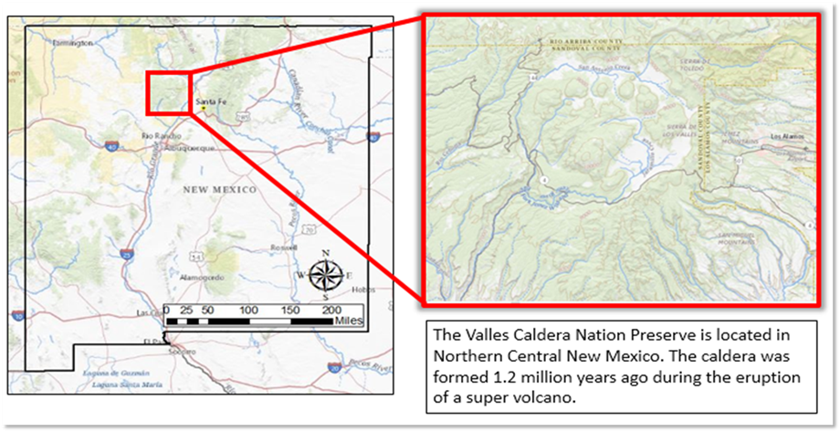
Background:
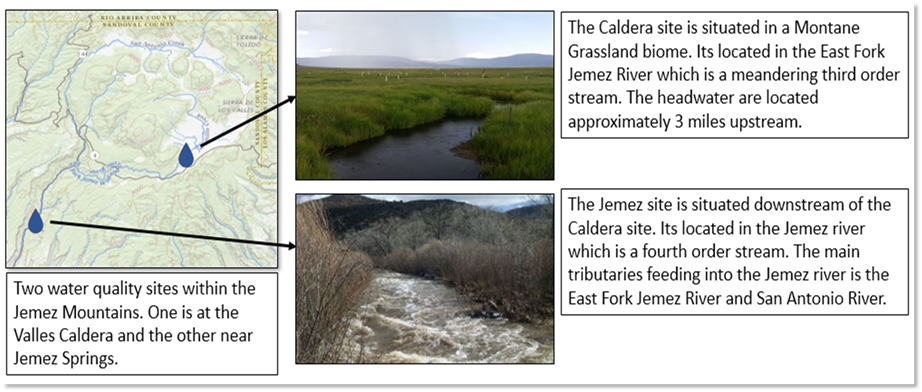
Motivation:
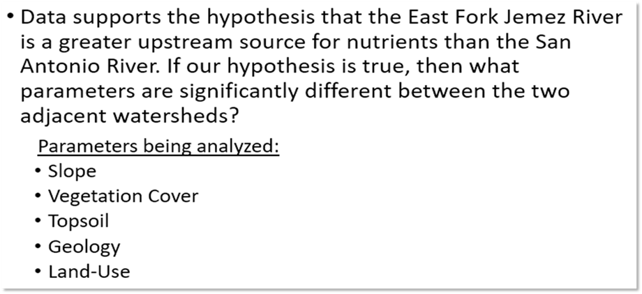
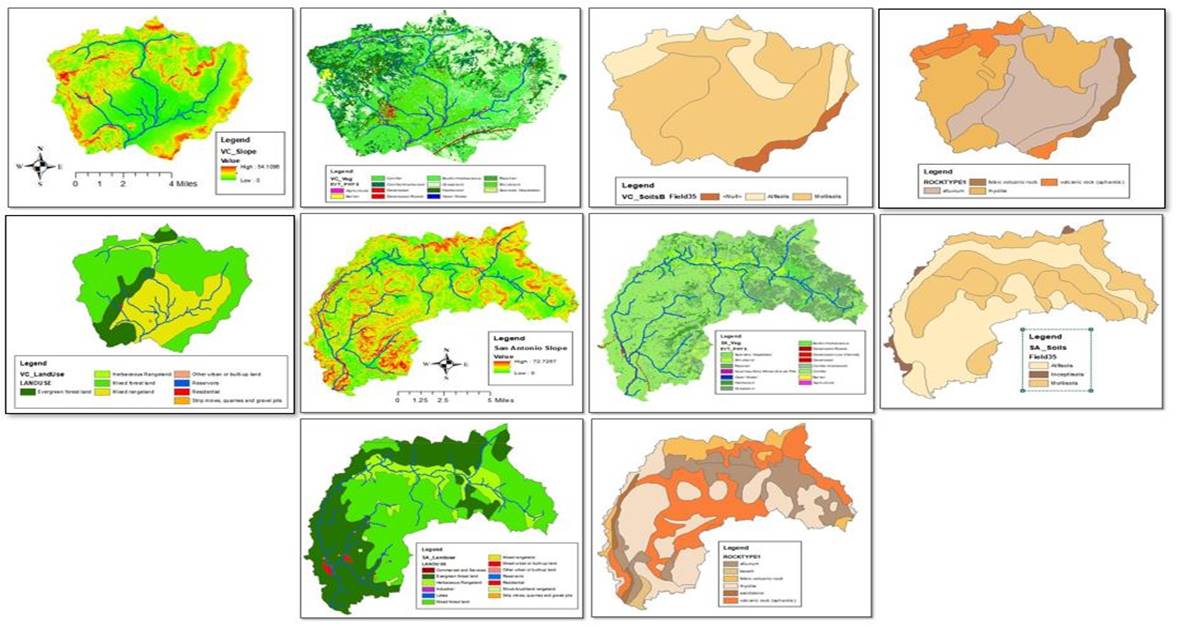
Analysis:
First, all data files were brought into
ArcMap and projected in North America Albers Equal Area Conic with a central
meridian of negative 106. Once data layers were added to data frame I went
through the process of basin delineation.
Process for Basin Delineation:
· Fill in pits
within DEM
· Perform flow
direction
· Define and clip
desired basin
· Calculate flow
accumulation and define stream thresholds
· Network streams
and define outlets
· Generate
individual watersheds within catchment basin
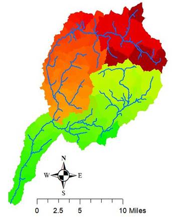
Once individual watersheds have been
defined, I extracted the catchment basins for the San Antonio and East Fork
rivers. Using the defined basins as footprints I was able to clip the data sets
of interest. Extracting the newly clipped data sets attributes tables, I was
able to determine percentages of total surface area cover.
Results:
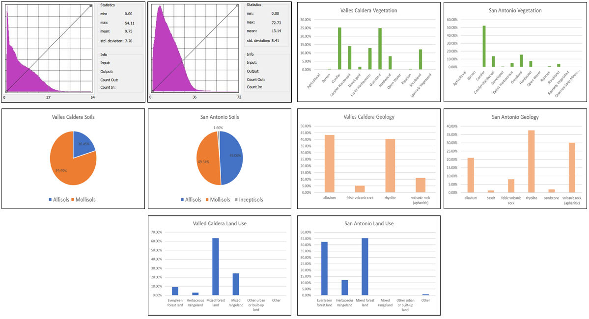
Key
Take-Away:
1.
There
were no clear matching parameters between the two watersheds.
2.
The
parameter with the most similarity between watersheds is most likely rock type;
however, there is still significant difference with Volcanic and Alluvium rock
types.
3.
A
possible hypothesis for high FDOM loads from the East Fork Jemez river based off
the results is that the gentler topography allows for greater higher
infiltration, and in combination with a high percentage of fertile Mollisols the increased groundwater input would have high
FDOM concentrations.
Data Sources:
· Digital Elevation
Map, USGS The National Map, Raster Data, https://viewer.nationalmap.gov/basic/
· Vegetation
Coverage, USGS The National Map, Raster Data,
https://viewer.nationalmap.gov/basic/
· Soil Coverage,
Natural Resources Conservation Service STATSGO2, Vector Data and Tables
http://websoilsurvey.sc.egov.usda.gov/App/HomePage.htm
· Land-Use Coverage,
USGS, Vector Data, https://water.usgs.gov/GIS/dsdl/ds240/index.html#poly
· Geology Coverage,
USGS Mineral Resource Program, Vector Data, http://pubs.usgs.gov/of/2005/1351