Methods
ArcGIS Pro was used to perform analysis and
mapping. Cross sections and water surface elevations (wse)
were exported from a HEC RAS hydraulic model provided by BOR. A shapefile of
the levees was also provided by BOR. The spatial reference used was NAD 1983
2011 State Plain New Mexico Central and the datum used was Transverse Mercator
because. The spatial reference and datum were chosen because of the high level
of accuracy obtained using a smaller zone on a localized project and it is the
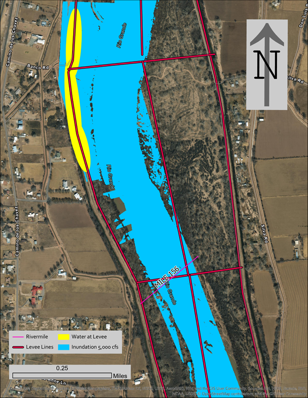
preferred spatial reference and datum used by BOR. The select by intersection
tool was used to locate were the wse for 5,000 cfs reached the levees. Shapefiles were then created for
all the selected areas. The shapefiles attribute tables were then updated to
include wse, velocity, shear stress and water depth
by doing a comparison of exported cross sections and the HEC RAS model for
future analysis.