Na Lu HOME
Homework 3
![]()
|
In this homework, I created three maps by using
different Coordinate System. |
|
|
World Map
Layout |
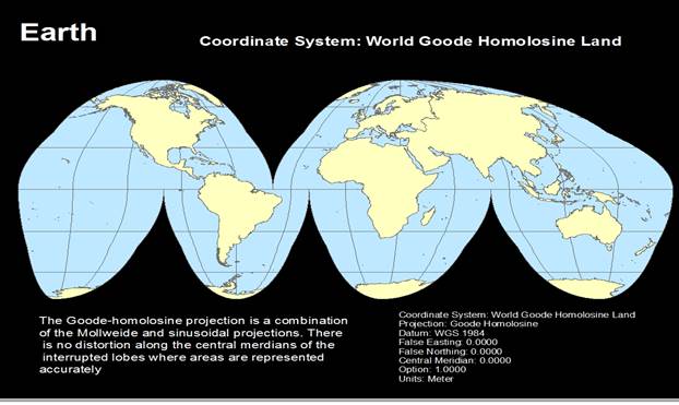
This map layout shows the earth by using the
World Goode Homolosine Land system. The coordinate
system parameter information is on the layout as well as the brief
description. |
|
US map –
measure distance |
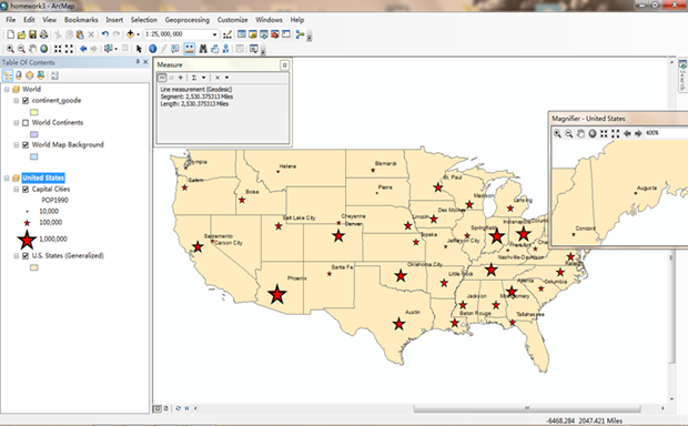
This is a screenshot of the distance measurement
between Olympia, WA and Augusta, ME. The distance is 2530.375 miles in the
default coordinate system. |
|
US map with a change in projection
|
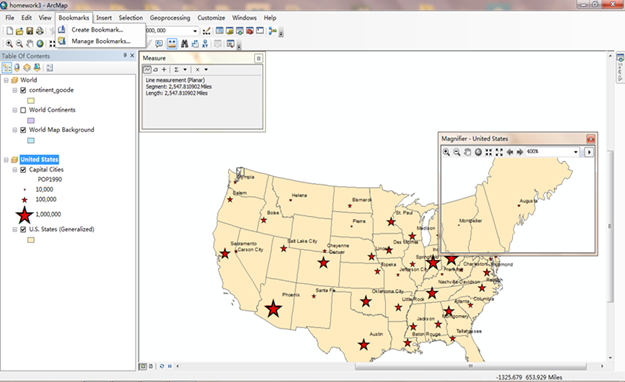
This screenshot shows the US map and distance
measure after a change in the geographic projection. The distance becomes
2547.811 under this system. |
|
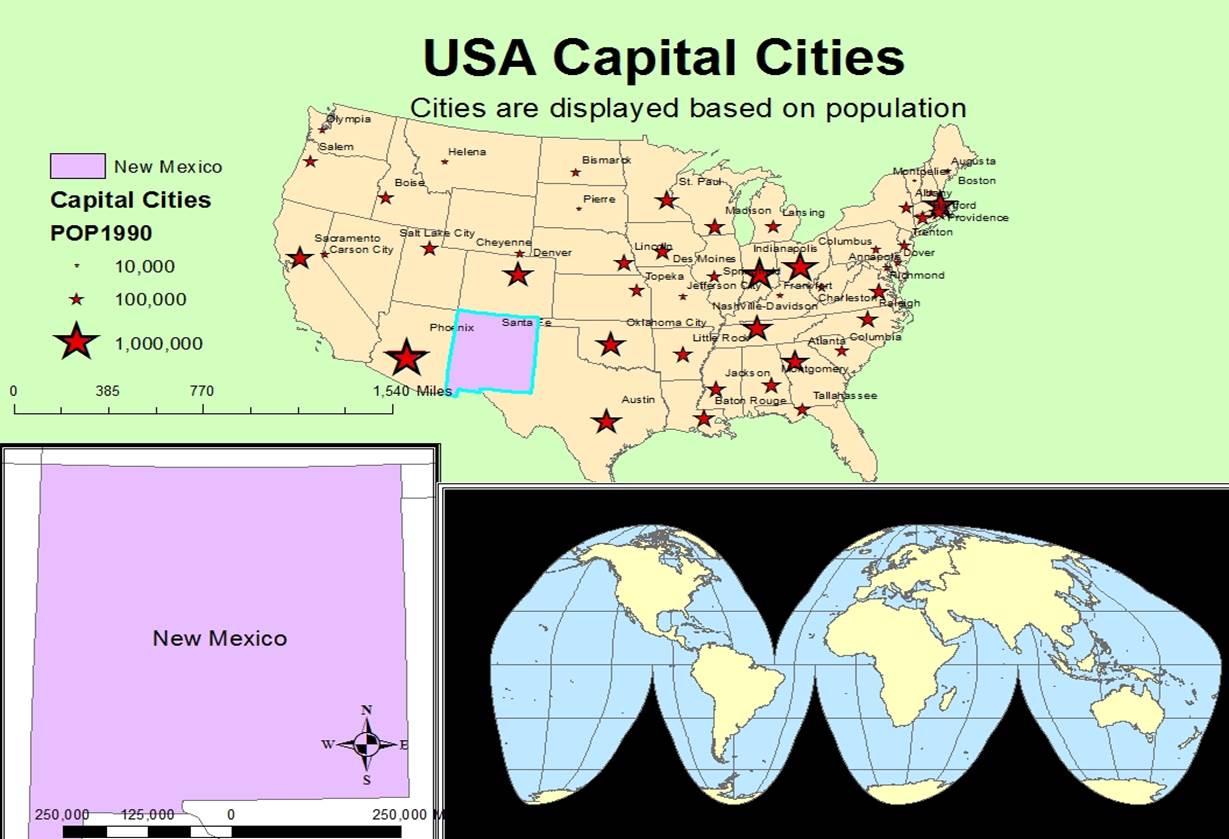
US Capital
Cities |
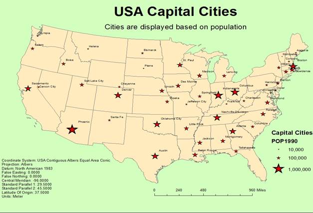
This map layout shows the capital cities for the
lower 48 states of US. The legend size represent the population number of
that city in 1990. The coordinate system information and scale bar is also
added to this layout. |
|
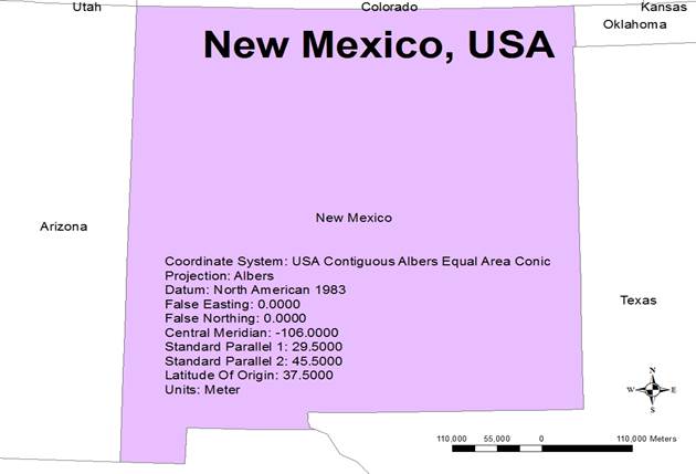
New Mexico
|
This map layout shows the projected map of New Mexico
with the central meridian -106. It also include scale bar, north arrow and
coordinate system information. |
|
Final Layout |
|
|
This layout
combines the three maps together, I deleted texts to make it more clear. |
|