Assignment #3: Map Projections
1)
Mapping the world: First,
I created a folder and extracted the world continent data with world 3D
background. Then I go to view > data frame properties and finally select the
coordinate systems. The world map has been projected using the World Goodes
Homolosine Land Projection.

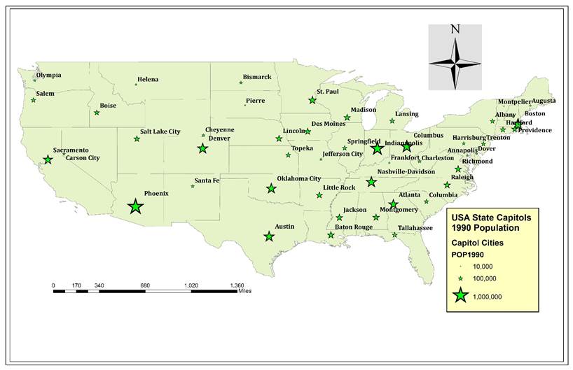
2)
Mapping the United
States:
This exercise consists of
mapping the USA and compare various information of different cities like
distances and coordinates.
The answer to the
questions are given below:
a) Determine the approximate latitude and longitude of
three cities
|
City |
Latitude |
Longitude |
|
Phoenix |
33.413149 |
-111.819485 |
|
Denver |
39.730618 |
-104.823870 |
|
Oklahoma
city |
35.304821 |
-97.685486 |
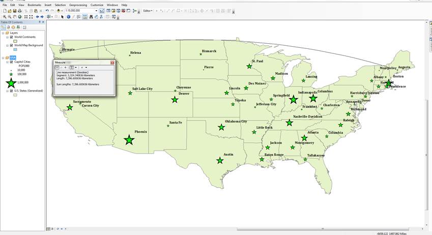
b) What is the distance between Augusta and Olympia in
miles if the view is not projected?
Ans:
2530.3798 miles.
c) What is the distance between Augusta and Olympia in
miles if the view is projected into Albers Equal Area?
Ans: 2547.81 miles.
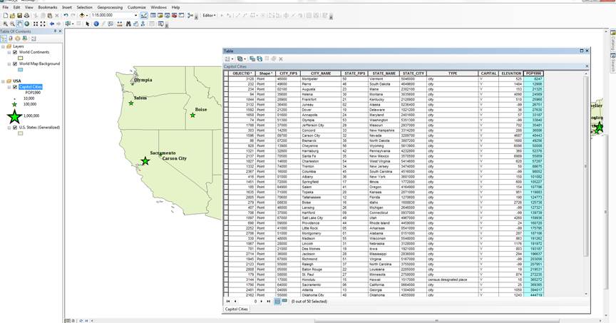
d) In the Cities attribute table, why do think there are several
values with –99 when looking into the elevation values?
Ans: I believe, the
reason is because of the change in the map projection system.
e) What are the same distances in kilometers?
Ans: If the views are not
projected, then the distance is 4072.26 Km. If the view is projected into
Albers Equal Area, then the distance is 4100.31 Km.
f) Which capital
city is the most populous?
Ans: Phoenix,
Arizona with population of 983403.
g) Which capital
city is the least populous?
Ans: Montpelier,
Vermont with population of 8247.
h) Which capital city has the highest elevation?
Ans: Santa Fe, New
Mexico with elevation of 6989 ft.
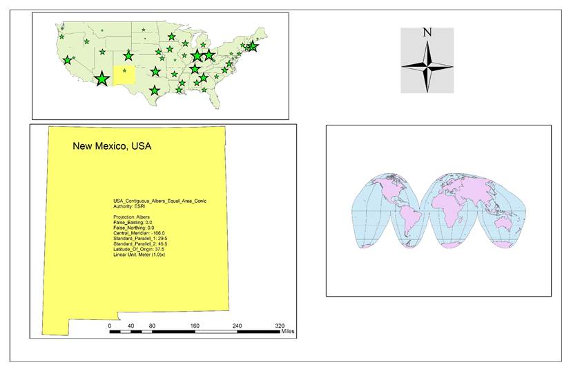
3)
Mapping New Mexico:
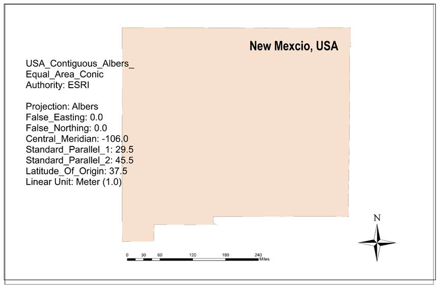
In order to accomplish
this task, I selected select feature tool and the clicked on the top of the New
Mexico state in the US cities map. After that, right click on US states >
export data. Finally I used the ArcToolbox to project New Mexico with a 106
central meridian.
4) Add maps to the website: All
of the maps were finally placed in the website and made it presentable.
This homework took too much time to figure out
everything and to finish.