Assignment 4: Basin Delineation
At
first, I downloaded the files from the unm learn and
made them a continuous surface using the mosaic tool from the ArcToolbox. The E177.E00 file was kept to work on and other
two were removed. Then I edited the metadata and include additional information
about the file. Next, I added colorized raster using symbology feature and a
base map was added.
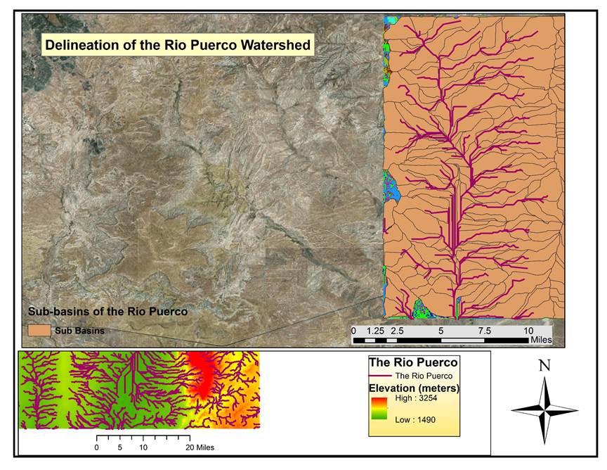
I
filled the missing data using the ArctoolBox. Then I
started the hydrologic part. Flow direction was created using flow direction
tool under the hydrology tool. Later, flow accumulation, stream and stream
network were generated. Streams were linked and turned into a polyline. After
that outlines were defined that appeared as dot on the polyline. Finally, I
delineated the watershed and converted the raster into polygons.