Assignment 5- Watershed Discharge
The
purpose of this assignment is to create several maps that represent the history
discharge data at the Pecos Headwaters basin. This involves downloading data
from USGS website and import into ArcGIS. In order to accomplish the task
first, I downloaded the data given for this particular assignment and opened it
in ArcGIS software. Using the definition query, I isolated the Rio Grande
basin. Later, the head water of the Rio Pecos was selected.
The
historical stream gage data for the Rio Pecos watershed was downloaded from
USGS website and exported it to an excel file before importing the excel file
to ArcGIS. The datum was changed to NAD 1983 so that the location of the gage
sited do not fall outside the map area.
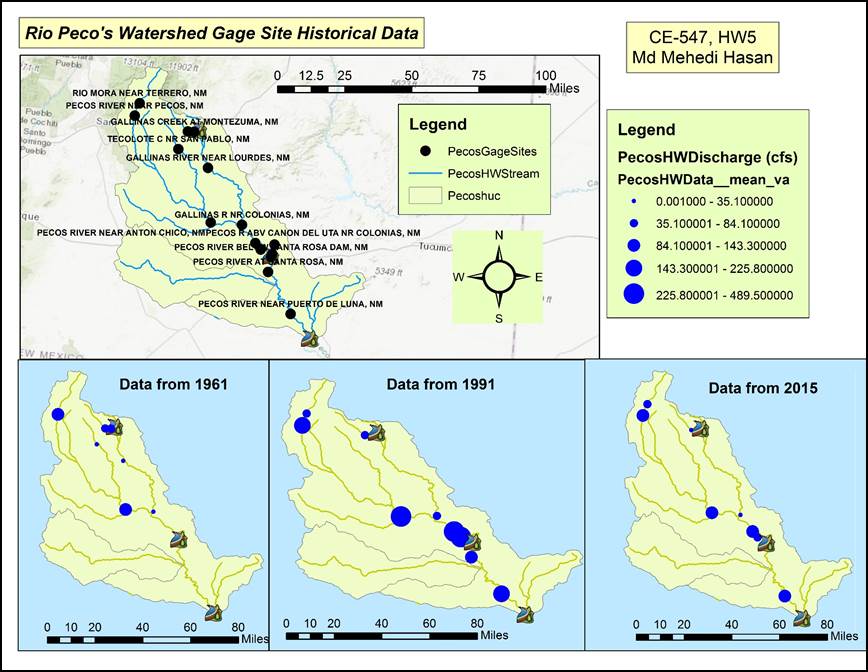
The
final map illustrates the gage sites in a watershed map and other three maps
show the mean discharge for years of 1961, 1991 and, 2015. The map tells a
story about the discharge of Rio Pecos watershed over time.