Assignment
1 write up
Webpage:
To
setup the webpage, firstly I designed my webpage in word. I saved the word file
as “index” in webpage format. It gave me an error initially because I did not
save the file name in all lower case. After that I added the link to my
assignment in the index file by highlighting the word, right clicking it and adding
a link to it. Then, through FileZilla I linked my webpage to my UNM ID. The only
confusion I face during linking my webpage to UNM username was to make sure the
files are in the same path and to update it every time and to name the files without
space.
Exercise:
For the exercise, we had to do exercise 3a to 3d from the
book or any online resource.
1.
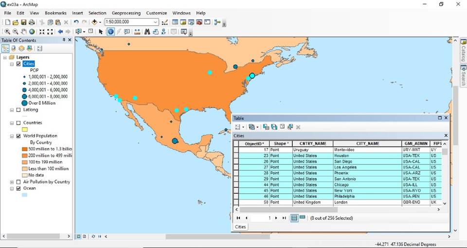
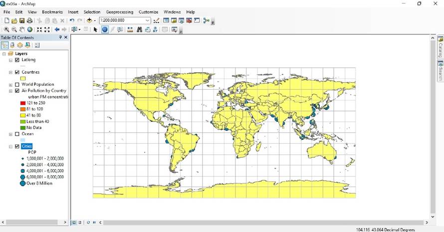
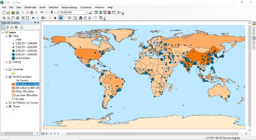
For 3a, I used the layer option in the
ArcGIS. I tried turning off the layers, moving/dragging the layer and looking
at the changes. The results are shown in my assignment 1 webpage, with cites
dragged below ocean and with selection of world population.
2.
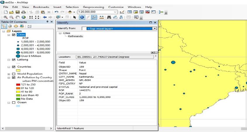
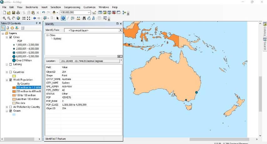
For 3b, I have used the identify tool, it
gives different features of any selected cities. My webpage shows Kathmandu and
Sydney.
3.
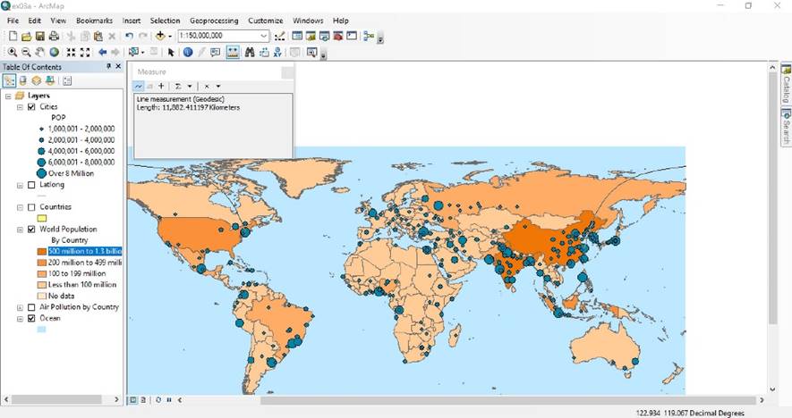
For 3c, I have used the measure tool to
calculate the distance between two cities. My webpage has an example of
distance between Shanghai and New York in kilometers. We are also able to
select different unit. The measure tool also gives the angle between two cities.
4.
For 3d, I was able to access the attribute
tables of cities around the world divided by their population. The selection I
made, US cities, were represented by the neon color in the map, as shown in my
webpage.