Analyzing Wildfire Risk by Topographic Characteristics in a large portion of the Gallinas Creek Watershed
Introduction Methods Results Conclusions/Future Work References
Introduction
New Mexico’s unique landscape comprises a diverse set of ecoregions ranging from the desert grasslands of the Chihuahuan Desert in the South to the subalpine forests of the Rocky Mountains in the North (Griffith et al., 2006). With impending climate change expected to result in more aridity and warmer temperatures (Gutzler, D. S., 2013), forested watersheds that offer vital resources and support a robust recreation economy are subject to longer, more severe fire seasons. Knowledge of areas that are vulnerable to wildfires is useful for watershed managers who wish to apply mitigation strategies and reduce the devastating impact of scorched land. Utilizing ArcGIS is an essential application that aids users in data visualization and analysis for wildfire management. Though wildfire regime and behavior are influenced by a number of variables like drought, weather, and fuel load, the scope of this project aims at the visualization of the topographic variables of slope (hillslope steepness) and aspect (compass direction a slope faces) that influence wildfire behavior. But what is it about topography that influences the effects of wildfire?
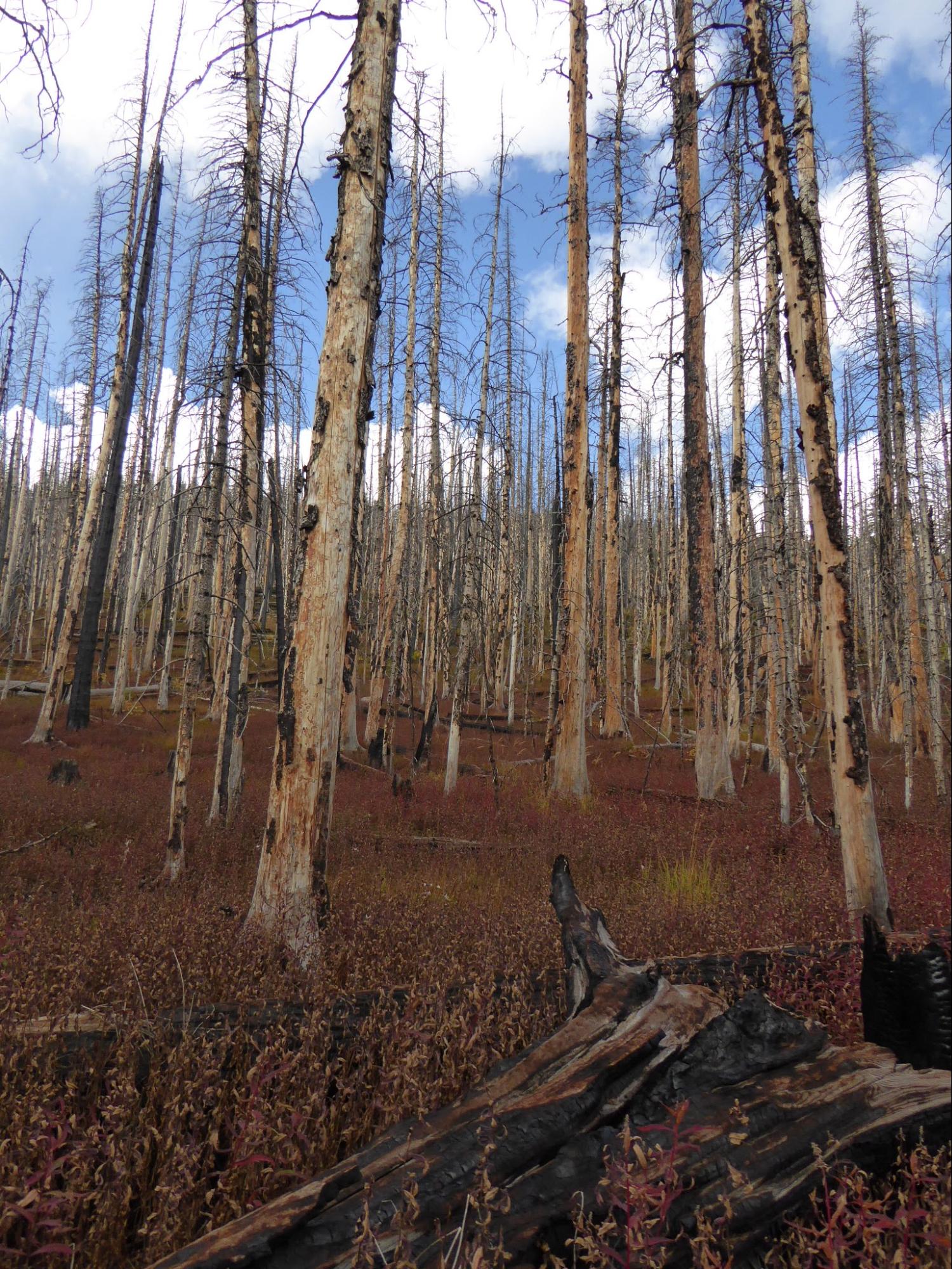
Radiant heat transfer and fuel preheating are considered two of the major influences of slope on wildfire behavior. As a warmed hillside releases heat from the day’s incoming solar radiation, cooler air begins to take its place, causing a draft to move upslope. Additionally, steeper slope surfaces have closer proximity to burning flames, allowing for the preheating of fuels to occur, increasing combustibility upslope as the fire ensues. The combination of preheating and updrafts results in increasing fire severity as slope becomes steeper (Rothermel, R. C., 1983).
The direction at which a slope faces (aspect) also affects the way wildfire behaves, primarily as a result of solar exposure. South and Southwest facing slopes are subject to increased amounts of solar radiation, resulting in hotter, more arid microclimates that may be distinguished from slopes with different aspect. The resulting microclimates of those slopes provide for drier soil content and fuels that are more readily combustible in wildfire (Carmo et al, 2011). By these variables, it makes sense that managers would be interested in the determination and assessment of those areas that may be subject to both topographic characteristics.
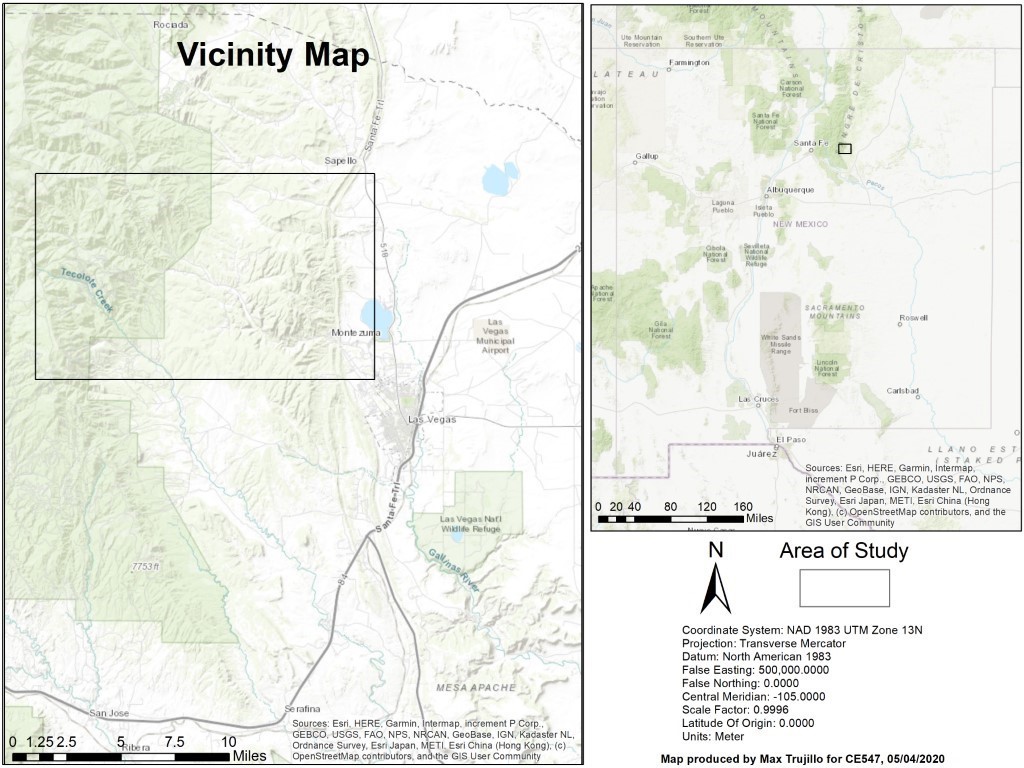
The objective of this project is to use ArcGIS to visualize data given from digital elevation models (DEMs) that represent slope and aspect for a large portion of the Gallinas Creek watershed (Figure 1), which provides water for the northern New Mexican town of Las Vegas. The deliverables are a series of four maps that display slope, aspect, aspect-slope of the entire study area, and aspect-slope for the South and Southwest facing slopes of the study area.
Figure 1 above displays the area of study, located in Northern NM at the Southeastern extent of the Sangre de Cristo mountains. The area contains a large portion of the Gallinas Creek watershed that provides water for the municipality of Las Vegas, NM.