·
The model utilized for this project was a
plug-in called the Automated Geospatial Watershed Assessment (AGWA) tool,
developed by Arizona State University.
·
The
analysis for this project was based on results produced using the KINEROS 2
model. KINEROS2 is the model typically used by Burn Area Emergency Response
(BEAR) teams for rapids post fire watershed assessment.
·
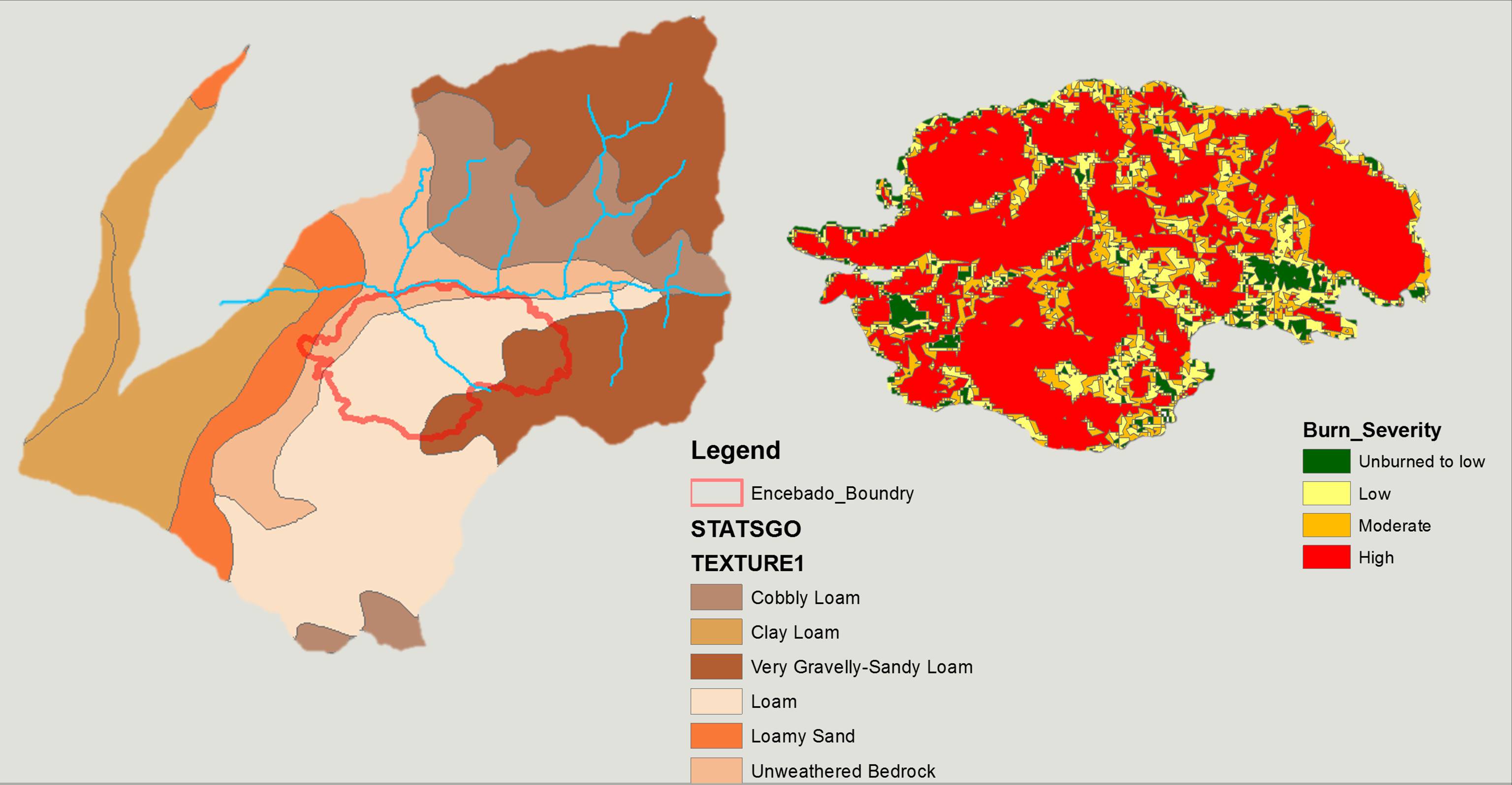
At minimum, the KINEROS2 model requires a
Digital Elevation Model (DEM), State Soil Geographic Database (STATSGO),
National Land Cover Data (NLCD), watershed boundaries, and burn severity map that is converted to polygons (Figure 3).
This project utilized all publicly available data sets.
· CREATING
MODEL INPUTS
1.) Before
running the AGWA model the user must delineate the watershed. To delineate the
watershed, AGWA first utilizes the Fill, Flow Direction, Flow Accumulation
tools from Arc Toolbox.
2.) Next
the user must subdivide the watershed into model specific elements.
Discretizing creates a stream feature class that drains the model elements.
3.) Next
the watershed must be parameterized for the KINEROS2 model. Parameterizing
defines model input parameters based on topographic, land cover, and soils properties.
Model input parameters represent the physical properties of the watershed and
are used to write the model input files.
4.) Next
the rainfall files are prepared for the model. AGWA offers several methods of
user-defined rainfall input. They include using a National Oceanic and
Atmospheric Administration (NOAA) Precipitation-Frequency grid, a user defined
storm, a user-defined hyetograph, or a pre-defined storm taken from a database.
For the purposes of this project, the storm was chosen by consulting a 10-year,
1-hour NOAA Precipitation-Frequency grid.
5.) Lastly,
the user must write the model input files. When writing the input files, AGWA
loops through features of the selected discretization and reads the model
parameters from the parameterization look-up tables to write into the input
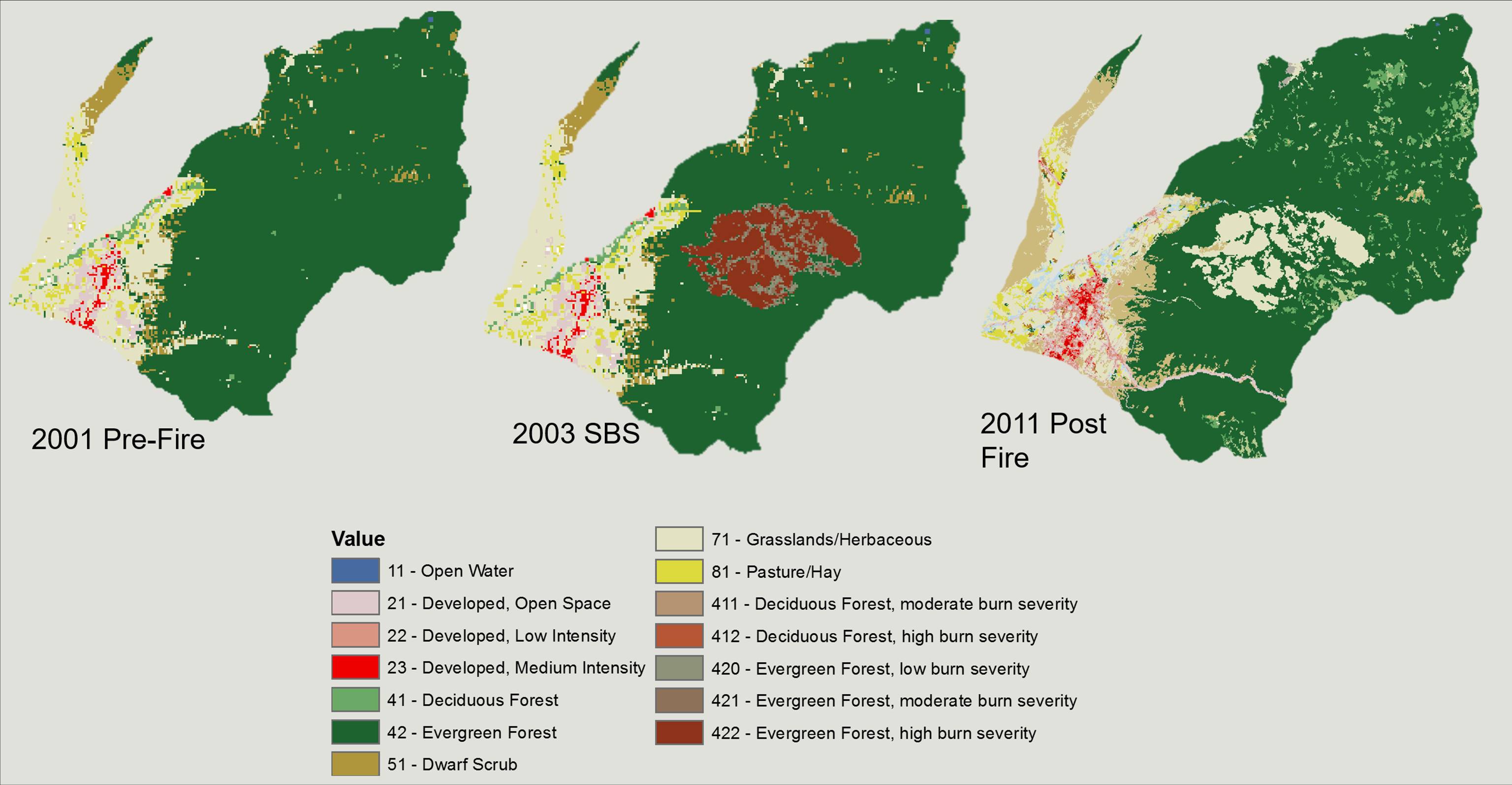
files for the model. This method is used to yield the results for the pre-fire
(2001) and post-fire recovery (2011) sediment yield.
· For
more in-depth directions for creating model inputs click Follow My Steps