Return to project Main Page Return to homepage
RESULTS
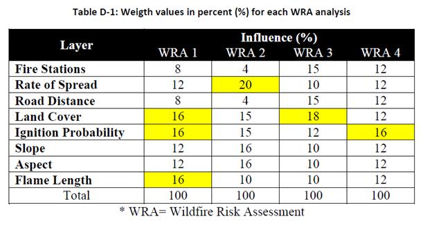
Refer to the table on the bottom of the page for influence values of each Layout.
 RESULTS