GEOG585: Internet
Mapping: Final
Question 1
1. Download 5 datasets (including at least 1 vector and 1 raster) that cover a common
region of interest (i.e. the city of Albuquerque, NM, etc.), and copy them to your
GeoServer data directory on the class server. Run ogrinfo or gdalinfo (as appropriate)
for each of the datasets you stored on the server. Print out the first 5 lines of the
output from gdalinfo or ogrinfo for each of the datasets. Keep in mind that these
data will be used for the remainder of the exam in setting up OGC services in
GeoServer, displaying in ArcGIS & QGIS, and setting up a web client interface in
OpenLayers, so, to simplify your life, select data formats that are directly supported
by GeoServer, preferably in a projection for which you know the EPSG code.
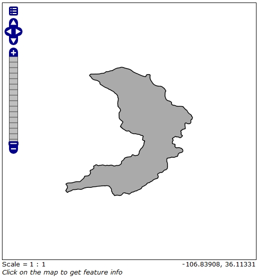
Layer name: RitoPenasNegras
Geometry: Polygon
Feature Count: 1
Extent: (-106.788104, 35.962788) - (-106.685155, 36.066907)
Layer SRS WKT:
GEOGCS["GCS_North_American_1983",
DATUM["North_American_Datum_1983",
SPHEROID["GRS_1980",6378137.0,298.257222101]],
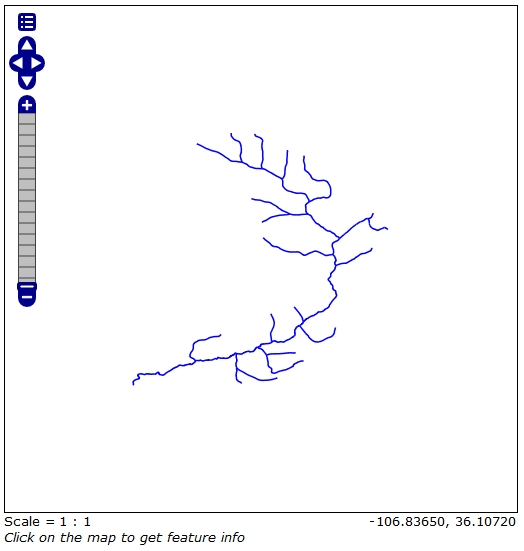
Layer name: RPN_Flow
Geometry: 3D Line String
Feature Count: 51
Extent: (-106.787013, 35.965155) - (-106.688402, 36.062754)
Layer SRS WKT:
GEOGCS["GCS_North_American_1983",
DATUM["North_American_Datum_1983",
SPHEROID["GRS_1980",6378137.0,298.257222101]],
Layer name: Vegetation
Geometry: Polygon
Feature Count: 2
Extent: (-106.793623, 35.958344) - (-106.680290, 36.071350)
Layer SRS WKT:
GEOGCS["GCS_WGS_1984",
DATUM["WGS_1984",
SPHEROID["WGS_1984",6378137.0,298.257223563]],
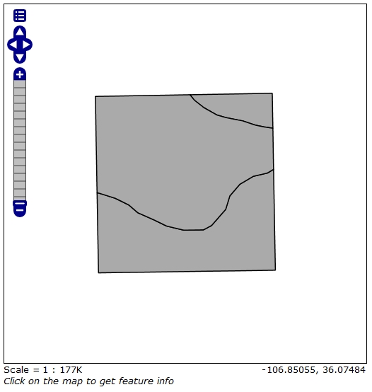
Layer name: Geology
Geometry: Polygon
Feature Count: 18
Extent: (-106.793623, 35.958344) - (-106.680290, 36.071350)
Layer SRS WKT:
GEOGCS["GCS_WGS_1984",
DATUM["WGS_1984",
SPHEROID["WGS_1984",6378137.0,298.257223563]],
Driver: GTiff/GeoTIFF
Files: 59790772.tif
59790772.tfw
Size is 437, 531
Coordinate System is:
PROJCS[" Projection Name = Albers Conical Equal Area Units = meters GeoTIFF Units = meters",
GEOGCS["NAD83",
DATUM["North_American_Datum_1983",
SPHEROID["GRS 1980",6378137,298.2572221010002,
Question 2
2. Add each of the layers to GeoServer through the creation of a single (new)
"Workspace" for the final exam, a new "store" for each of the datasets, and one new
"layer" for each of the stores. Include a screenshot of each of the five new layers
from the GeoServer "Layer Preview" tool.
Question 3
3. Display any three of the layers in QGIS and include screenshots of the three
layers in your writeup. Do the same for any three layers in ArcGIS
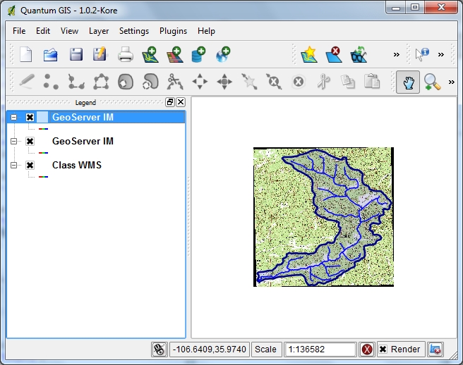
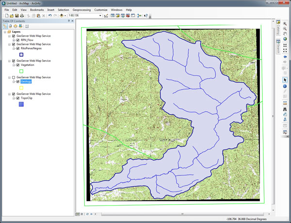
Interesting the opacity styles show up in QGIS but not in ArcGIS.
Question 4
4. Create a new OpenLayers web mapping client (based upon the example files
covered in the lecture, and providing the basis for the previous lab assignments) that
includes 5 WMS services that you created in GeoServer (in 2 above). Include in
your writeup screenshots of you OpenLayers client showing each of the five
layers (i.e. displaying the map images delivered by your GeoServer services).
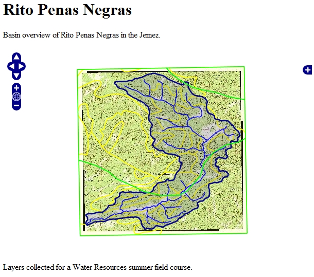
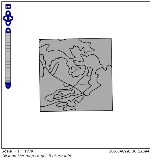
OpenLayers Map
Question 4
5. Further customize the mapping client generated for question 4 by modifying the
HTML to include a description of the data that are included in the map.
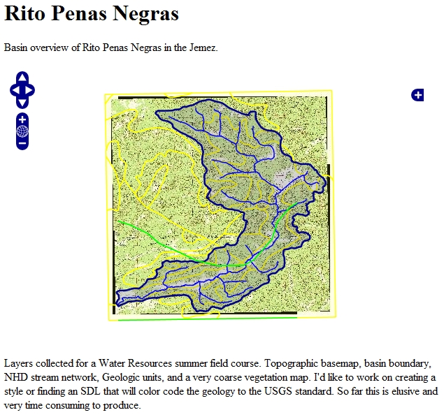
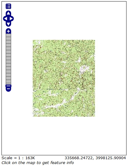
OpenLayers Map
|