

|
|
|
|
|
|
|
|
|
|
|
|
|
|||||||||
|
|
|||||||||
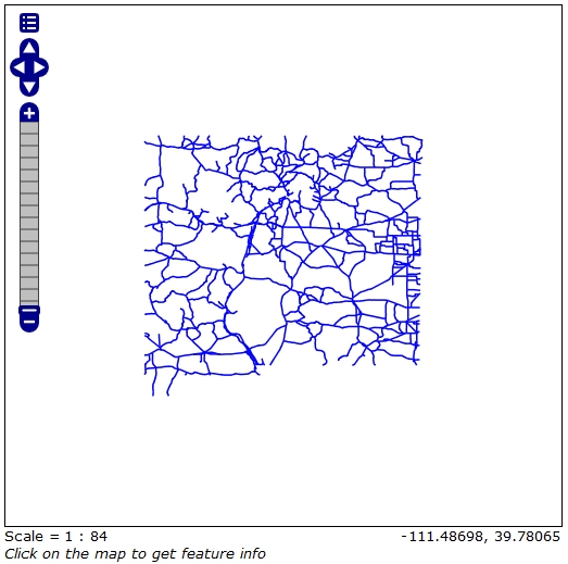
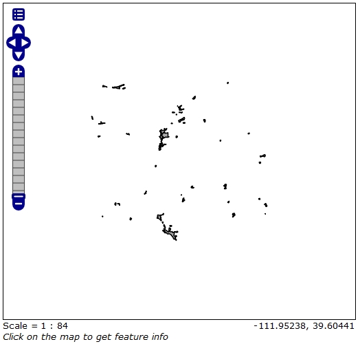
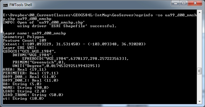
GEOG585: Internet Mapping: Home Work 4Question 11. Create a new workspace on the class GeoServer (http://129.24.63.138/geoserver) for your Done Question 22. Add your initial datasets from Assignment 3 into GeoServer through the standard process of Done Question 33. Display each of your added layers in the "Open Layers" "Layer Preview" and include in your
Question 44. Identify and acquire 3 additional datasets for use in your project. Include the first 5 lines of I only have one layer to show here right now. After spending hours downloading orthophotos I realized that they are not compatible with GeoServer without an ERDAS license. I discovered work arounds but they are too time consuming given the spatial extent of my project area. When playing with topos I found a small clip of a topo map too big to serve (~100mb) without tiling. Lots of time with nothing to show for it. This summer I'm going to work more with preparing gridded data and writing scripts to preprocess some larger datasets.
|