
The GRNDB is an example of a hybrid software system that uses individual computer software products as subcomponents. A combination of SAS, CA-DISSPLA, FORTRAN, and ARC/INFO components are used. The GRNDB handles traffic safety and transportation planning GIS problems very efficiently because the individual strengths of each software subcomponent are built upon as they are combined into a larger software package (tool-box).
 A new version of the GRNDB had been developed that replaced CA-DISSPLA
software with PGPLOT. PGPLOT is a non-public domain (freely available
for non-commercial use) graphics subroutine library developed at the
California Institute of Technology. DGR began using this new
PGPLOT version of the GRNDB beginning in November 1999 (the CA-DISSPLA
license is not being renewed). See the link provided below for more
information about the PGPLOT Graphics Package.
A new version of the GRNDB had been developed that replaced CA-DISSPLA
software with PGPLOT. PGPLOT is a non-public domain (freely available
for non-commercial use) graphics subroutine library developed at the
California Institute of Technology. DGR began using this new
PGPLOT version of the GRNDB beginning in November 1999 (the CA-DISSPLA
license is not being renewed). See the link provided below for more
information about the PGPLOT Graphics Package.
SAS (Statistical Analysis System) Macros are the building blocks and the user interface for the GRNDB system. All of New Mexico's traffic crash data were maintained by DGR as SAS files. Having a GIS that is directly related to the data saves time and effort. Also, many of the database management and statistical analysis tools in SAS can be easily used as integral components of the GRNDB system.
The SAS Macros that compose the GRNDB system pass data and instructions to CA-DISSPLA and PGPLOT specialized FORTRAN routines to produce publication quality maps. These maps can be produced on graphics terminals, plotters, color printers, or any of several standard graphic file formats. The construction and editing of basemaps for the GRNDB system was done in ARC/INFO and later ArcGIS. ARC/INFO coverages can be read or written(created) using special SAS Macros that are also part of the GRNDB system.
The GRNDB system originally operated on IBM mainframe computers under MVS, most UNIX platforms, and also DEC VMS. A recent version was developed on a PC under Windows XP and Windows 7. In order for the GRNDB to operate, both SAS and CA-DISSPLA or PGPLOT need to be licensed on the host computer.
|
 |
 |
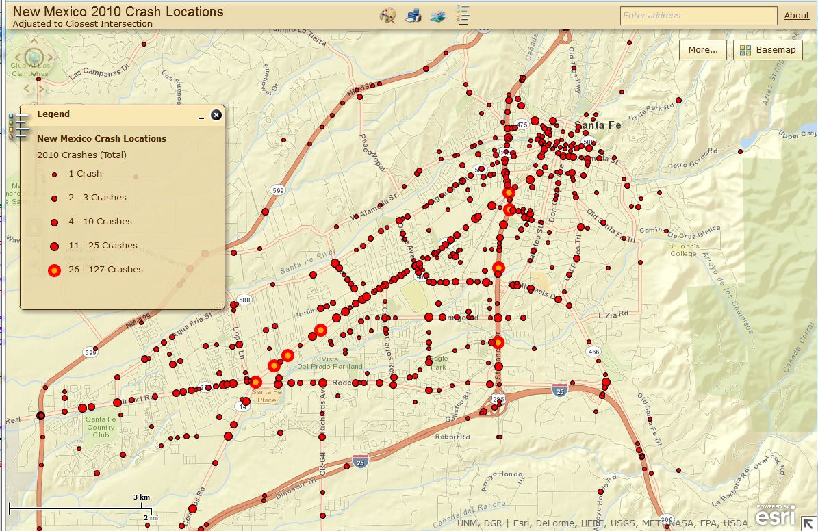 |
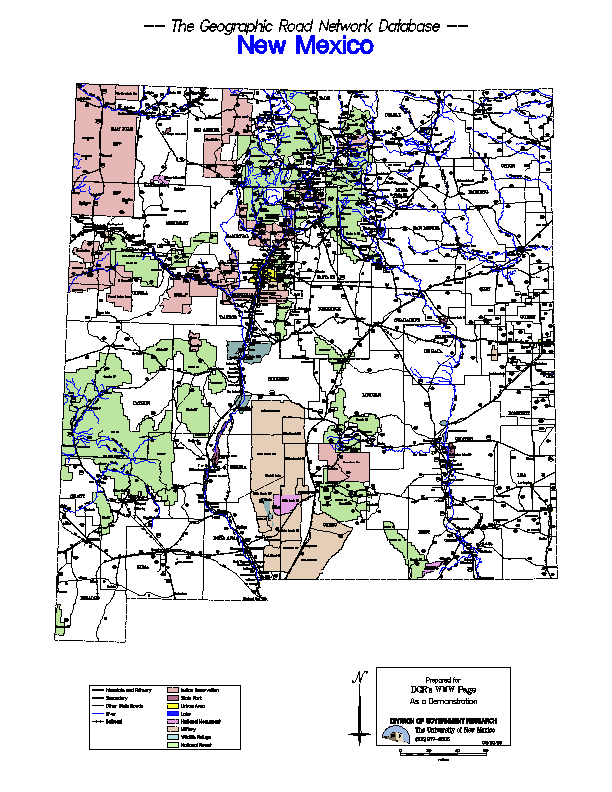
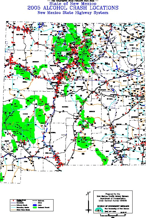
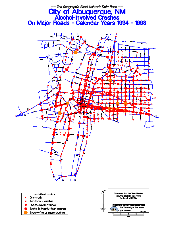
| New Mexico Base Map | Rural Crash Data | Urban Crash Data | Interactive Web Maps |
 Some of the major features of the GRNDB system are:
- Linear referencing and linear interpolation (dynamic segmentation) used to plot crash and other transportation data (event) locations on roads that can use many route measurement (milelog, etc.) systems.
- Matching crash and other transportation data (events) to intersections (cross streets) by street names (character strings) using aliases. A SAS based intersection file with associated aliases is created and the SAS Merge facility is used to obtain coordinates of intersections in order to plot the data.
- Ability to translate locations between many linear referencing and route measurement systems. Can be used as a "Rosetta Stone" to pass data to other statistical, transportation, and GIS applications.
- Linkages to several address matching facilities (UNIMATCH, AUTOMATCH, ARC/INFO, and ArcView) using SAS routines to share data among address matching facilities and the GRNDB. The GRNDB easily maps address geocoded data that matches basemaps.
- Automatic text placement for all annotation associated with features on maps produced by the GRNDB. Linear (street names, etc.) and point based (cities, road medallions) text are automatically re-sized and positioned according to the output scale of the map.
- Automatic placement of other map elements such as titles, scale bars, north arrows, and legend according to the output scale of the map.
- A variety of geometric (triangles, dots, markers, etc.) shapes and patterns available to depict point or segment based data. Also, the ability to flip, stack, and offset point based shapes when many data (events) are at the same location (route measurement).
- SAS Macros provide a wealth of intelligent default values that make producing publication quality maps for a variety of data a relatively quick and easy task.
- Complete compatability with the wide spectrum of SAS database and statistical analysis facilities. Adding and developing specialized routines to solve non-ordinary problems can be accomplished with the wealth of programming and analytical tools provided by SAS.
-
California Institute of Technology (PGPLOT)
- CA - Computer Associates (CA-DISSPLA)
- ESRI - Environmental Systems Research Institute (ARC/INFO)
- SAS Institute (SAS)
- CA - Computer Associates (CA-DISSPLA)
Address and Contact Information:
     Larry Spear, Sr. Research Scientist (Ret.)
     Division of Government Research
     Non-degree Graduate Student
     University of New Mexico

     Home Phone: (505) 260-1810
     Email: lspear@unm.edu
     WWW: http://www.unm.edu/~lspear
 UNM's Home Page
Last Revised: 1/8/2015 Larry Spear (lspear@unm.edu)