Vegetation Modeling on the Ladder Ranch,
New Mexico
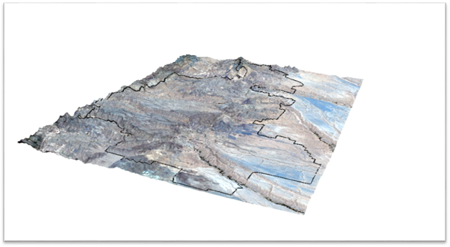
3D rendering of the Ladder Ranch
Introduction
The Ladder
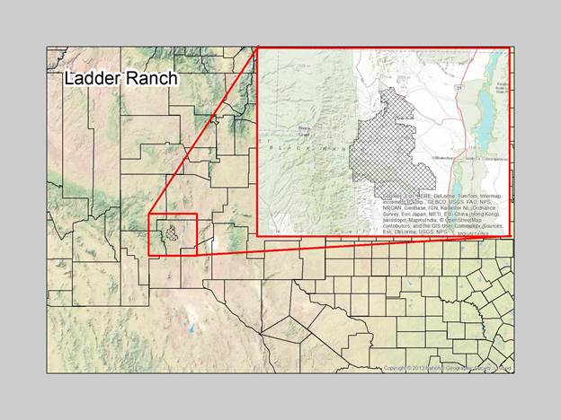
Ranch is a 156, 000 acre property in Sierra County, New Mexico. It is a large
and relatively floristically unknown piece of land adjacent to the Black Mountain
Range. The Ranch is privately owned by Ted Turner who is a keenly interested in
having a floristic inventory carried out on the land. The Ranch has a rich
potential for diverse plant communities due, in part, to the occurrence of
persistent and intermittent streams, and little anthropogenic degradation.
Starting
in spring of 2015 I will be starting the collection of plant specimens from throughout
the Ladder. The use of GIS and mapping
is critical for the collection and spatial analysis of the property.
Main Questions
Modeling
Results
Conclusion