


|
|
|
|
|
|
|
|||
Detecting Neogene uplift along the Jemez lineament with GIS > Results
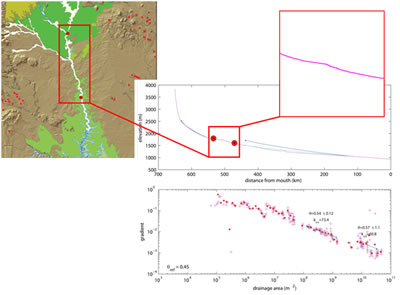
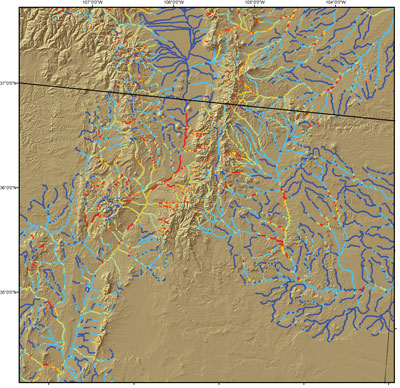
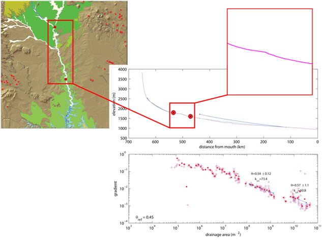
Initial results look promising. The knick points in the longitudinal profiles match nicely with the bedrock controls on the Rio Grande, as expected. Lava flows creating the convexity in the river profile are clearly visible in orange on the map generated in ArcMap. The markers showing beginning and end of knick points line up nicely with the boundaries of the basalt. |
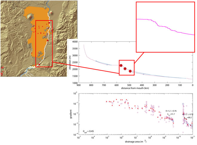
On the Canadian river we see slight doming of the longitudinal profile. A much more subtle convexity but still something that needs explaining and there are no bedrock controls on this reach of the river. All surface geology is relatively soft sandstone and limestone. This is an excellent case to fit the doming hypothesis. Google Earth of Canadian River
|
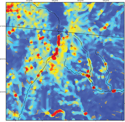
Matlab exported data of the slope/area analysis picks out "hot spots" where the slope of the river is anomalous for the drainage basin serving that area. These maps match the regions of convexities or knickpoints on the longitudinal river profiles. Future locations for field work may be determined from this GIS output.
|
|
Conclusions: Preliminary results look promising. The slope/area maps show regions where field work or high resolution DEMs may yield valid quantitative evidence of uplift clearly isolated from bedrock or climate controls. More fine tuning is necessary to extract the proper data from the Matlab analysis to yield a publishable paper.
|
|
| Project Home | Next > |
| Analysis | Results | Future Work |
